Seymchan geodata
Seymchan (Magadan Oblast) is a populated place; located in Russia in Asia/Magadan (GMT+11) time zone. With population of 3,455 people, there are 3427 cities with bigger population in this country. Compared to other cities in Russia, 96.2% of cities are located further ↓South; 99.4% of cities are located further ←West and 74.3% of cities have lower elevation than Seymchan. Note1


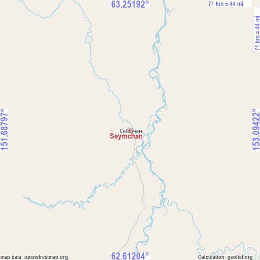
Seymchan GPS coordinates[2]
62° 56' 1.428" North, 152° 23' 27.924" East
| Map corner | latitude | longitude |
|---|---|---|
| Upper-left | 63.25192°, | 151.68797° |
| Center: | 62.93373°, | 152.39109° |
| Lower-right: | 62.61204°, | 153.09422° |
| Map W x H: | 71.1×71.1 km | = 44.2×44.2mi |
| max Lat: | 73.50819° ⇑3.8% North |
| Seymchan: | 62.93373° |
| min Lat: | ⇓96.2% South 41.28413° |
| min Long | Seymchan | max Long |
| -179.12198° | 152.39109° | 179.35046° |
| W 99.4%⇐ | ⇒0.59999999999999% E |
Elevation
Elevation of Seymchan is 213 m = 699 ft, and this is 10.4 m = 34 ft above average elevation for this country.
| Max E: |
2518 m = 8261 ft | 25.7% |
| Seymchan | 213 m 699 ft | |
| Avg. | 202.6 m = 665 ft | |
Min E: |
-28 m = -92 ft | 74.3% |
See also: Russia elevation on elevation.city.
Geographical zone
Seymchan is located in North temperate zone (between Tropic of Cancer and the Arctic Circle). Distance of this North polar circle is 403.6 km =250.8 mi to North.| Distance of | km | miles | from Seymchan |
|---|---|---|---|
| North Pole | 3009.5 | 1870 | to North |
| Arctic Circle | 403.6 | 250.8 | to North |
| Tropic Cancer | 4391.7 | 2728.9 | to South |
| Equator | 6997.6 | 4348.1 | to South |


Nearby cities:
15 places around Seymchan: (largest is in red/bold)
• Atka
235.5 km =146.3 mi,  187°
187°
• Burkhala
169.6 km =105.4 mi,  259°
259°
• Debin
106.3 km =66.1 mi,  231°
231°
• Dukat
155.9 km =96.9 mi,  104°
104°
• Karamken
310.6 km =193 mi, 192°
• Omsukchan
179.3 km =111.4 mi,  105°
105°
• Orotukan
83 km =51.6 mi,  206°
206°
• Palatka
324.2 km =201.4 mi, 193°
• Sinegor'ye
134.3 km =83.5 mi, 225°
• Sokol
346.4 km =215.2 mi, 194°
• Spornoye
93 km =57.8 mi,  224°
224°
• Talaya
174.9 km =108.7 mi,  173°
173°
• Ust’-Omchug
246.4 km =153.1 mi, 215°
• Yagodnoye
147.9 km =91.9 mi,  252°
252°
• Zyryanka
319.7 km =198.7 mi,  346°
346°
Sources, notices
• [Note1] Compared only with cities in Russia existing in our database
• [Src1] Map data: © OpenStreetMap contributors (CC-BY-SA)
• [Src2] Other city data from geonames.org with taken over terms of usage.
• [Src3] Geographical zone / Annual Mean Temperature by Robert A. Rohde @ Wikipedia
