Talaya geodata
Talaya (Magadan Oblast) is a populated place; located in Russia in Asia/Magadan (GMT+11) time zone. With population of 1,054 people, there are 4605 cities with bigger population in this country. Compared to other cities in Russia, 93.9% of cities are located further ↓South; 99.4% of cities are located further ←West and 92.5% of cities have lower elevation than Talaya. Note1


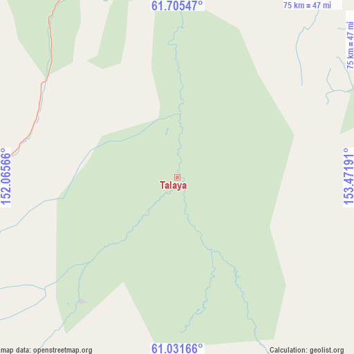
Talaya GPS coordinates[2]
61° 22' 13.368" North, 152° 46' 7.608" East
| Map corner | latitude | longitude |
|---|---|---|
| Upper-left | 61.70547°, | 152.06566° |
| Center: | 61.37038°, | 152.76878° |
| Lower-right: | 61.03166°, | 153.47191° |
| Map W x H: | 74.9×74.9 km | = 46.5×46.5mi |
| max Lat: | 73.50819° ⇑6.1% North |
| Talaya: | 61.37038° |
| min Lat: | ⇓93.9% South 41.28413° |
| min Long | Talaya | max Long |
| -179.12198° | 152.76878° | 179.35046° |
| W 99.4%⇐ | ⇒0.59999999999999% E |
Elevation
Elevation of Talaya is 521 m = 1709 ft, and this is 318.4 m = 1045 ft above average elevation for this country.
| Max E: |
2518 m = 8261 ft | 7.5% |
| Talaya | 521 m 1709 ft | |
| Avg. | 202.6 m = 665 ft | |
Min E: |
-28 m = -92 ft | 92.5% |
See also: Russia elevation on elevation.city.
Geographical zone
Talaya is located in North temperate zone (between Tropic of Cancer and the Arctic Circle). Distance of this North polar circle is 577.4 km =358.8 mi to North.| Distance of | km | miles | from Talaya |
|---|---|---|---|
| North Pole | 3183.3 | 1978 | to North |
| Arctic Circle | 577.4 | 358.8 | to North |
| Tropic Cancer | 4217.8 | 2620.8 | to South |
| Equator | 6823.7 | 4240 | to South |


Nearby cities:
15 places around Talaya: (largest is in red/bold)
• Atka
79.5 km =49.4 mi,  221°
221°
• Debin
151 km =93.8 mi,  315°
315°
• Dukat
189.8 km =117.9 mi,  45°
45°
• Karamken
157.9 km =98.1 mi, 215°
• Ola
214.9 km =133.5 mi,  202°
202°
• Omsukchan
202.9 km =126.1 mi, 51°
• Orotukan
114.9 km =71.4 mi,  329°
329°
• Palatka
172.7 km =107.3 mi, 215°
• Seymchan
174.9 km =108.7 mi,  353°
353°
• Sinegor'ye
142.7 km =88.7 mi,  303°
303°
• Sokol
195.4 km =121.4 mi,  214°
214°
• Spornoye
138.8 km =86.2 mi, 321°
• Uptar
193.5 km =120.2 mi, 212°
• Ust’-Omchug
169.7 km =105.4 mi,  261°
261°
• Yagodnoye
208.3 km =129.4 mi,  307°
307°
Sources, notices
• [Note1] Compared only with cities in Russia existing in our database
• [Src1] Map data: © OpenStreetMap contributors (CC-BY-SA)
• [Src2] Other city data from geonames.org with taken over terms of usage.
• [Src3] Geographical zone / Annual Mean Temperature by Robert A. Rohde @ Wikipedia
