Ust’-Omchug geodata
Ust’-Omchug (Magadan Oblast) is a populated place; located in Russia in Asia/Magadan (GMT+11) time zone. With population of 4,515 people, there are 2858 cities with bigger population in this country. Compared to other cities in Russia, 93.3% of cities are located further ↓South; 99.1% of cities are located further ←West and 94% of cities have lower elevation than Ust’-Omchug. Note1


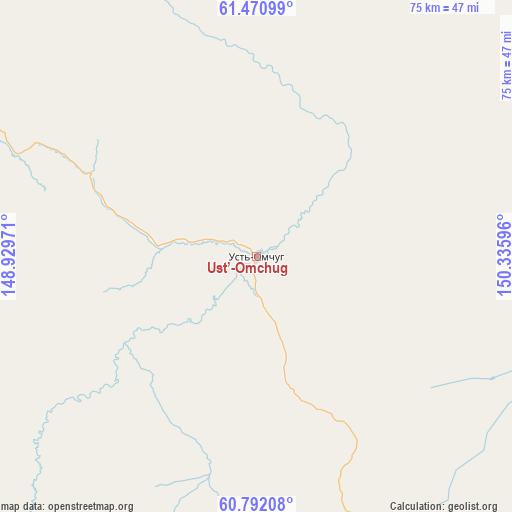
Ust’-Omchug GPS coordinates[2]
61° 8' 0.096" North, 149° 37' 58.188" East
| Map corner | latitude | longitude |
|---|---|---|
| Upper-left | 61.47099°, | 148.92971° |
| Center: | 61.13336°, | 149.63283° |
| Lower-right: | 60.79208°, | 150.33596° |
| Map W x H: | 75.5×75.5 km | = 46.9×46.9mi |
| max Lat: | 73.50819° ⇑6.7% North |
| Ust’-Omchug: | 61.13336° |
| min Lat: | ⇓93.3% South 41.28413° |
| min Long | Ust’-Omchug | max Long |
| -179.12198° | 149.63283° | 179.35046° |
| W 99.1%⇐ | ⇒0.90000000000001% E |
Elevation
Elevation of Ust’-Omchug is 580 m = 1903 ft, and this is 377.4 m = 1238 ft above average elevation for this country.
| Max E: |
2518 m = 8261 ft | 6% |
| Ust’-Omchug | 580 m 1903 ft | |
| Avg. | 202.6 m = 665 ft | |
Min E: |
-28 m = -92 ft | 94% |
See also: Russia elevation on elevation.city.
Geographical zone
Ust’-Omchug is located in North temperate zone (between Tropic of Cancer and the Arctic Circle). Distance of this North polar circle is 603.8 km =375.2 mi to North.| Distance of | km | miles | from Ust’-Omchug |
|---|---|---|---|
| North Pole | 3209.7 | 1994.4 | to North |
| Arctic Circle | 603.8 | 375.2 | to North |
| Tropic Cancer | 4191.5 | 2604.5 | to South |
| Equator | 6797.4 | 4223.7 | to South |


Nearby cities:
15 places around Ust’-Omchug: (largest is in red/bold)
• Arman’
165 km =102.5 mi,  170°
170°
• Atka
120.9 km =75.1 mi,  105°
105°
• Burkhala
170.6 km =106 mi,  350°
350°
• Debin
146.8 km =91.2 mi,  23°
23°
• Karamken
130 km =80.8 mi,  142°
142°
• Magadan
186 km =115.6 mi,  159°
159°
• Ola
195.7 km =121.6 mi,  152°
152°
• Orotukan
165.4 km =102.8 mi,  40°
40°
• Palatka
134.9 km =83.8 mi, 148°
• Sinegor'ye
116.1 km =72.1 mi, 23°
• Sokol
148.3 km =92.1 mi, 155°
• Spornoye
155.1 km =96.4 mi,  30°
30°
• Talaya
169.7 km =105.4 mi,  81°
81°
• Uptar
153.1 km =95.1 mi, 153°
• Yagodnoye
154.6 km =96.1 mi,  359°
359°
Sources, notices
• [Note1] Compared only with cities in Russia existing in our database
• [Src1] Map data: © OpenStreetMap contributors (CC-BY-SA)
• [Src2] Other city data from geonames.org with taken over terms of usage.
• [Src3] Geographical zone / Annual Mean Temperature by Robert A. Rohde @ Wikipedia
