Nizhnesortymskiy geodata
Nizhnesortymskiy (Khanty-Mansia) is a populated place; located in Russia in Asia/Yekaterinburg (GMT+5) time zone. With population of 15,204 people, there are 1083 cities with bigger population in this country. Compared to other cities in Russia, 95.5% of cities are located further ↓South; 77.3% of cities are located further ←West and 79.2% of cities have higher elevation than Nizhnesortymskiy. Note1


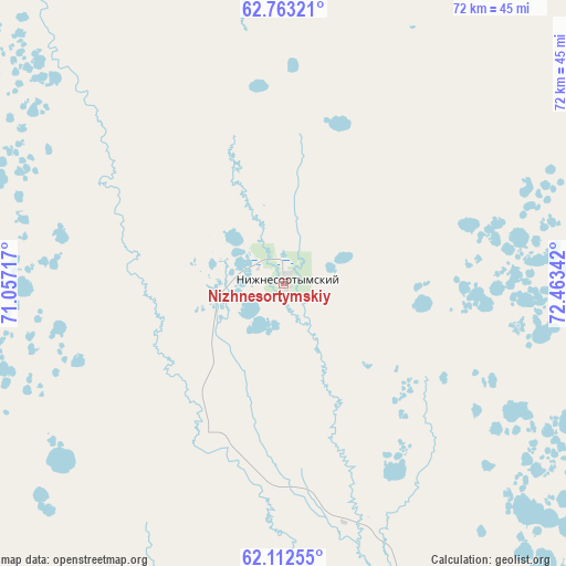
Nizhnesortymskiy GPS coordinates[2]
62° 26' 22.74" North, 71° 45' 37.044" East
| Map corner | latitude | longitude |
|---|---|---|
| Upper-left | 62.76321°, | 71.05717° |
| Center: | 62.43965°, | 71.76029° |
| Lower-right: | 62.11255°, | 72.46342° |
| Map W x H: | 72.3×72.3 km | = 44.9×44.9mi |
| max Lat: | 73.50819° ⇑4.5% North |
| Nizhnesortymskiy: | 62.43965° |
| min Lat: | ⇓95.5% South 41.28413° |
| min Long | Nizhnesortymski | max Long |
| -179.12198° | 71.76029° | 179.35046° |
| W 77.3%⇐ | ⇒22.7% E |
Elevation
Elevation of Nizhnesortymskiy is 73 m = 240 ft, and this is 129.6 m = 425 ft below average elevation for this country.
| Max E: |
2518 m = 8261 ft | 79.2% |
| Avg. | 202.6 m = 665 ft | |
| Nizhnesortymskiy | 73 m = 240 ft | |
Min E: |
-28 m = -92 ft | 20.8% |
See also: Russia elevation on elevation.city.
Geographical zone
Nizhnesortymskiy is located in North temperate zone (between Tropic of Cancer and the Arctic Circle). Distance of this North polar circle is 458.5 km =284.9 mi to North.| Distance of | km | miles | from Nizhnesortymskiy |
|---|---|---|---|
| North Pole | 3064.4 | 1904.1 | to North |
| Arctic Circle | 458.5 | 284.9 | to North |
| Tropic Cancer | 4336.7 | 2694.7 | to South |
| Equator | 6942.6 | 4313.9 | to South |


Nearby cities:
15 places around Nizhnesortymskiy: (largest is in red/bold)
• Barsovo
159.7 km =99.2 mi,  152°
152°
• Fedorovskiy
137.7 km =85.6 mi,  132°
132°
• Khanty-Mansiysk
215.8 km =134.1 mi,  222°
222°
• Kogalym
141.6 km =88 mi,  97°
97°
• Lyantor
93.5 km =58.1 mi,  167°
167°
• Muravlenko
204.5 km =127.1 mi,  42°
42°
• Nefteyugansk
155.4 km =96.6 mi,  163°
163°
• Noyabrsk
204.7 km =127.2 mi,  65°
65°
• Pokachi
204.1 km =126.8 mi,  113°
113°
• Poykovskiy
157.5 km =97.9 mi, 148°
• Pyt-Yakh
196.7 km =122.2 mi, 162°
• Russkinskiye
100.3 km =62.3 mi, 108°
• Singapay
150.5 km =93.5 mi, 161°
• Solnechniy
149 km =92.6 mi, 149°
• Surgut
158.3 km =98.4 mi, 146°
Sources, notices
• [Note1] Compared only with cities in Russia existing in our database
• [Src1] Map data: © OpenStreetMap contributors (CC-BY-SA)
• [Src2] Other city data from geonames.org with taken over terms of usage.
• [Src3] Geographical zone / Annual Mean Temperature by Robert A. Rohde @ Wikipedia
