Kotel’nikovo geodata
Kotel’nikovo (Volgograd Oblast) is a populated place; located in Russia in Europe/Volgograd (GMT+3) time zone. With population of 19,622 people, there are 884 cities with bigger population in this country. Compared to other cities in Russia, 81% of cities are located further ↑North; 56.1% of cities are located further →East and 84.4% of cities have higher elevation than Kotel’nikovo. Note1


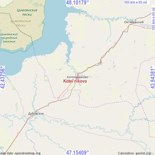
Kotel’nikovo GPS coordinates[2]
47° 37' 48.324" North, 43° 8' 26.448" East
| Map corner | latitude | longitude |
|---|---|---|
| Upper-left | 48.10179°, | 42.43756° |
| Center: | 47.63009°, | 43.14068° |
| Lower-right: | 47.15409°, | 43.84381° |
| Map W x H: | 105.4×105.4 km | = 65.5×65.5mi |
| max Lat: | 73.50819° ⇑81% North |
| Kotel’nikovo: | 47.63009° |
| min Lat: | ⇓19% South 41.28413° |
| min Long | Kotel’nikovo | max Long |
| -179.12198° | 43.14068° | 179.35046° |
| W 43.9%⇐ | ⇒56.1% E |
Elevation
Elevation of Kotel’nikovo is 50 m = 164 ft, and this is 152.6 m = 501 ft below average elevation for this country.
| Max E: |
2518 m = 8261 ft | 84.4% |
| Avg. | 202.6 m = 665 ft | |
| Kotel’nikovo | 50 m = 164 ft | |
Min E: |
-28 m = -92 ft | 15.6% |
See also: Russia elevation on elevation.city.
Geographical zone
Kotel’nikovo is located in North temperate zone (between Tropic of Cancer and the Arctic Circle). Distance of this North polar circle is 2105.2 km =1308.1 mi to North.| Distance of | km | miles | from Kotel’nikovo |
|---|---|---|---|
| North Pole | 4711.1 | 2927.3 | to North |
| Arctic Circle | 2105.2 | 1308.1 | to North |
| Tropic Cancer | 2690.1 | 1671.6 | to South |
| Equator | 5296 | 3290.8 | to South |


Nearby cities:
15 places around Kotel’nikovo: (largest is in red/bold)
• Chernyshkovskiy
111 km =69 mi,  322°
322°
• Dubovskoye
36.8 km =22.9 mi,  229°
229°
• Krasnoarmeyskiy
98.4 km =61.1 mi, 225°
• Krasnoyarskaya
73.2 km =45.5 mi,  258°
258°
• Krasnoyarskaya
82.2 km =51.1 mi,  271°
271°
• Nizhniy Chir
81.2 km =50.5 mi,  357°
357°
• Oblivskaya
111.4 km =69.2 mi,  334°
334°
• Romanovskaya
84 km =52.2 mi, 263°
• Sadovoye
104.6 km =65 mi,  80°
80°
• Sovetskoye
109.8 km =68.2 mi,  108°
108°
• Surovikino
110.8 km =68.8 mi,  348°
348°
• Tsimlyansk
77.8 km =48.3 mi, 271°
• Volgodonsk
75.3 km =46.8 mi, 260°
• Zavetnoye
80.1 km =49.8 mi,  135°
135°
• Zimovniki
73.6 km =45.7 mi,  223°
223°
Sources, notices
• [Note1] Compared only with cities in Russia existing in our database
• [Src1] Map data: © OpenStreetMap contributors (CC-BY-SA)
• [Src2] Other city data from geonames.org with taken over terms of usage.
• [Src3] Geographical zone / Annual Mean Temperature by Robert A. Rohde @ Wikipedia
