Votkinsk geodata
Votkinsk (Udmurtiya Republic) is a populated place; located in Russia in Europe/Samara (GMT+4) time zone. With population of 98,633 people, there are 216 cities with bigger population in this country. Compared to other cities in Russia, 77.7% of cities are located further ↓South; 65.6% of cities are located further ←West and 75.8% of cities have higher elevation than Votkinsk. Note1


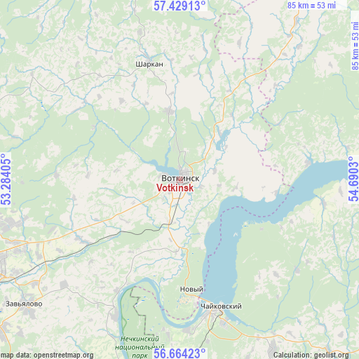
Votkinsk GPS coordinates[2]
57° 2' 55.14" North, 53° 59' 13.812" East
| Map corner | latitude | longitude |
|---|---|---|
| Upper-left | 57.42913°, | 53.28405° |
| Center: | 57.04865°, | 53.98717° |
| Lower-right: | 56.66423°, | 54.6903° |
| Map W x H: | 85×85 km | = 52.8×52.8mi |
| max Lat: | 73.50819° ⇑22.3% North |
| Votkinsk: | 57.04865° |
| min Lat: | ⇓77.7% South 41.28413° |
| min Long | Votkinsk | max Long |
| -179.12198° | 53.98717° | 179.35046° |
| W 65.6%⇐ | ⇒34.4% E |
Elevation
Elevation of Votkinsk is 85 m = 279 ft, and this is 117.6 m = 386 ft below average elevation for this country.
| Max E: |
2518 m = 8261 ft | 75.8% |
| Avg. | 202.6 m = 665 ft | |
| Votkinsk | 85 m = 279 ft | |
Min E: |
-28 m = -92 ft | 24.2% |
See also: Votkinsk elevation on elevation.city.
Geographical zone
Votkinsk is located in North temperate zone (between Tropic of Cancer and the Arctic Circle). Distance of this North polar circle is 1058 km =657.4 mi to North.| Distance of | km | miles | from Votkinsk |
|---|---|---|---|
| North Pole | 3663.8 | 2276.6 | to North |
| Arctic Circle | 1058 | 657.4 | to North |
| Tropic Cancer | 3737.3 | 2322.2 | to South |
| Equator | 6343.2 | 3941.5 | to South |


Nearby cities:
15 places around Votkinsk: (largest is in red/bold)
• Agryz
84.3 km =52.4 mi,  225°
225°
• Chastyye
65.1 km =40.5 mi,  65°
65°
• Chaykovskiy
32.1 km =19.9 mi,  166°
166°
• Debesy
67.9 km =42.2 mi,  350°
350°
• Foki
45.3 km =28.1 mi,  150°
150°
• Igra
79.4 km =49.3 mi,  315°
315°
• Izhevsk
52.4 km =32.6 mi,  245°
245°
• Kama
82.9 km =51.5 mi,  175°
175°
• Khokhryaki
42.9 km =26.7 mi, 249°
• Malaya Purga
81.1 km =50.4 mi, 227°
• Pirogovo
59 km =36.7 mi,  239°
239°
• Sarapul
64.7 km =40.2 mi,  190°
190°
• Sharkan
28.7 km =17.8 mi, 345°
• Sigayevo
70.9 km =44.1 mi, 190°
• Yelovo
56.5 km =35.1 mi,  89°
89°
Sources, notices
• [Note1] Compared only with cities in Russia existing in our database
• [Src1] Map data: © OpenStreetMap contributors (CC-BY-SA)
• [Src2] Other city data from geonames.org with taken over terms of usage.
• [Src3] Geographical zone / Annual Mean Temperature by Robert A. Rohde @ Wikipedia
