Sigayevo geodata
Sigayevo (Udmurtiya Republic) is a populated place; located in Russia in Europe/Samara (GMT+4) time zone. With population of 5,780 people, there are 2338 cities with bigger population in this country. Compared to other cities in Russia, 71.8% of cities are located further ↓South; 65.4% of cities are located further ←West and 75.5% of cities have higher elevation than Sigayevo. Note1


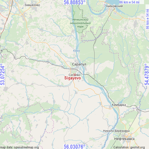
Sigayevo GPS coordinates[2]
56° 25' 17.868" North, 53° 46' 32.376" East
| Map corner | latitude | longitude |
|---|---|---|
| Upper-left | 56.80853°, | 53.07254° |
| Center: | 56.42163°, | 53.77566° |
| Lower-right: | 56.03076°, | 54.47879° |
| Map W x H: | 86.5×86.5 km | = 53.7×53.7mi |
| max Lat: | 73.50819° ⇑28.2% North |
| Sigayevo: | 56.42163° |
| min Lat: | ⇓71.8% South 41.28413° |
| min Long | Sigayevo | max Long |
| -179.12198° | 53.77566° | 179.35046° |
| W 65.4%⇐ | ⇒34.6% E |
Elevation
Elevation of Sigayevo is 86 m = 282 ft, and this is 116.6 m = 383 ft below average elevation for this country.
| Max E: |
2518 m = 8261 ft | 75.5% |
| Avg. | 202.6 m = 665 ft | |
| Sigayevo | 86 m = 282 ft | |
Min E: |
-28 m = -92 ft | 24.5% |
See also: Russia elevation on elevation.city.
Geographical zone
Sigayevo is located in North temperate zone (between Tropic of Cancer and the Arctic Circle). Distance of this North polar circle is 1127.7 km =700.7 mi to North.| Distance of | km | miles | from Sigayevo |
|---|---|---|---|
| North Pole | 3733.6 | 2320 | to North |
| Arctic Circle | 1127.7 | 700.7 | to North |
| Tropic Cancer | 3667.6 | 2278.9 | to South |
| Equator | 6273.5 | 3898.2 | to South |


Nearby cities:
15 places around Sigayevo: (largest is in red/bold)
• Agidel’
58 km =36 mi,  170°
170°
• Agryz
49.2 km =30.6 mi,  282°
282°
• Amzya
42.9 km =26.7 mi,  118°
118°
• Chaykovskiy
43.8 km =27.2 mi,  28°
28°
• Foki
46.4 km =28.8 mi,  49°
49°
• Izhevsk
59 km =36.7 mi,  323°
323°
• Kama
23.5 km =14.6 mi, 123°
• Kambarka
31.6 km =19.6 mi, 123°
• Karakulino
45.7 km =28.4 mi,  185°
185°
• Kiyasovo
40.9 km =25.4 mi,  258°
258°
• Malaya Purga
49.7 km =30.9 mi,  287°
287°
• Neftekamsk
47.5 km =29.5 mi,  140°
140°
• Nikolo-Berëzovka
40.5 km =25.2 mi, 144°
• Pirogovo
55.3 km =34.4 mi, 316°
• Sarapul
6.2 km =3.9 mi,  12°
12°
Sources, notices
• [Note1] Compared only with cities in Russia existing in our database
• [Src1] Map data: © OpenStreetMap contributors (CC-BY-SA)
• [Src2] Other city data from geonames.org with taken over terms of usage.
• [Src3] Geographical zone / Annual Mean Temperature by Robert A. Rohde @ Wikipedia
