Pirogovo geodata
Pirogovo (Udmurtiya Republic) is a populated place; located in Russia in Europe/Samara (GMT+4) time zone. With population of 3,363 people, there are 3491 cities with bigger population in this country. Compared to other cities in Russia, 75.1% of cities are located further ↓South; 64.9% of cities are located further ←West and 71.9% of cities have higher elevation than Pirogovo. Note1


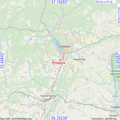
Pirogovo GPS coordinates[2]
56° 46' 46.524" North, 53° 8' 58.344" East
| Map corner | latitude | longitude |
|---|---|---|
| Upper-left | 57.16283°, | 52.44642° |
| Center: | 56.77959°, | 53.14954° |
| Lower-right: | 56.39239°, | 53.85267° |
| Map W x H: | 85.7×85.7 km | = 53.3×53.3mi |
| max Lat: | 73.50819° ⇑24.9% North |
| Pirogovo: | 56.77959° |
| min Lat: | ⇓75.1% South 41.28413° |
| min Long | Pirogovo | max Long |
| -179.12198° | 53.14954° | 179.35046° |
| W 64.9%⇐ | ⇒35.1% E |
Elevation
Elevation of Pirogovo is 98 m = 322 ft, and this is 104.6 m = 343 ft below average elevation for this country.
| Max E: |
2518 m = 8261 ft | 71.9% |
| Avg. | 202.6 m = 665 ft | |
| Pirogovo | 98 m = 322 ft | |
Min E: |
-28 m = -92 ft | 28.1% |
See also: Russia elevation on elevation.city.
Geographical zone
Pirogovo is located in North temperate zone (between Tropic of Cancer and the Arctic Circle). Distance of this North polar circle is 1087.9 km =676 mi to North.| Distance of | km | miles | from Pirogovo |
|---|---|---|---|
| North Pole | 3693.8 | 2295.2 | to North |
| Arctic Circle | 1087.9 | 676 | to North |
| Tropic Cancer | 3707.4 | 2303.7 | to South |
| Equator | 6313.3 | 3922.9 | to South |


Nearby cities:
15 places around Pirogovo: (largest is in red/bold)
• Agryz
30.3 km =18.8 mi,  198°
198°
• Chaykovskiy
58.8 km =36.5 mi,  91°
91°
• Foki
73.8 km =45.9 mi,  97°
97°
• Izhevsk
8.5 km =5.3 mi,  23°
23°
• Khokhryaki
18.4 km =11.4 mi,  34°
34°
• Kiyasovo
47.9 km =29.8 mi,  181°
181°
• Malaya Purga
26.3 km =16.3 mi, 199°
• Mozhga
67.6 km =42 mi,  236°
236°
• Pychas
53.1 km =33 mi,  234°
234°
• Sarapul
52 km =32.3 mi,  130°
130°
• Sharkan
72.4 km =45 mi,  37°
37°
• Sigayevo
55.3 km =34.4 mi,  136°
136°
• Uva
63.1 km =39.2 mi,  291°
291°
• Vavozh
74.2 km =46.1 mi,  269°
269°
• Votkinsk
59 km =36.7 mi,  59°
59°
Sources, notices
• [Note1] Compared only with cities in Russia existing in our database
• [Src1] Map data: © OpenStreetMap contributors (CC-BY-SA)
• [Src2] Other city data from geonames.org with taken over terms of usage.
• [Src3] Geographical zone / Annual Mean Temperature by Robert A. Rohde @ Wikipedia
