Verkhniy Mamon geodata
Verkhniy Mamon (Voronezj) is a populated place; located in Russia in Europe/Moscow (GMT+3) time zone. With population of 8,278 people, there are 1755 cities with bigger population in this country. Compared to other cities in Russia, 77.6% of cities are located further ↑North; 65.6% of cities are located further →East and 72.9% of cities have higher elevation than Verkhniy Mamon. Note1


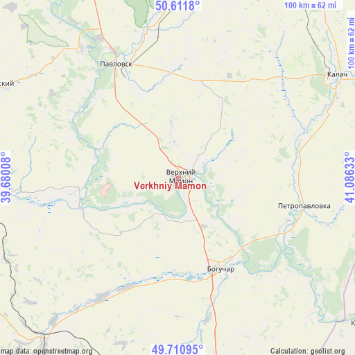
Verkhniy Mamon GPS coordinates[2]
50° 9' 48.6" North, 40° 22' 59.52" East
| Map corner | latitude | longitude |
|---|---|---|
| Upper-left | 50.6118°, | 39.68008° |
| Center: | 50.1635°, | 40.3832° |
| Lower-right: | 49.71095°, | 41.08633° |
| Map W x H: | 100.2×100.2 km | = 62.3×62.3mi |
| max Lat: | 73.50819° ⇑77.6% North |
| Verkhniy Mamon: | 50.1635° |
| min Lat: | ⇓22.4% South 41.28413° |
| min Long | Verkhniy Mamon | max Long |
| -179.12198° | 40.3832° | 179.35046° |
| W 34.4%⇐ | ⇒65.6% E |
Elevation
Elevation of Verkhniy Mamon is 94 m = 308 ft, and this is 108.6 m = 356 ft below average elevation for this country.
| Max E: |
2518 m = 8261 ft | 72.9% |
| Avg. | 202.6 m = 665 ft | |
| Verkhniy Mamon | 94 m = 308 ft | |
Min E: |
-28 m = -92 ft | 27.1% |
See also: Russia elevation on elevation.city.
Geographical zone
Verkhniy Mamon is located in North temperate zone (between Tropic of Cancer and the Arctic Circle). Distance of this North polar circle is 1823.5 km =1133.1 mi to North.| Distance of | km | miles | from Verkhniy Mamon |
|---|---|---|---|
| North Pole | 4429.4 | 2752.3 | to North |
| Arctic Circle | 1823.5 | 1133.1 | to North |
| Tropic Cancer | 2971.7 | 1846.5 | to South |
| Equator | 5577.7 | 3465.8 | to South |


Nearby cities:
15 places around Verkhniy Mamon: (largest is in red/bold)
• Belogor’ye
45 km =28 mi,  323°
323°
• Boguchar
27.8 km =17.3 mi,  155°
155°
• Buturlinovka
75.1 km =46.7 mi,  12°
12°
• Kalach
54.2 km =33.7 mi,  57°
57°
• Kantemirovka
62.9 km =39.1 mi,  216°
216°
• Kazanskaya
68.4 km =42.5 mi,  127°
127°
• Losevo
61.9 km =38.5 mi,  337°
337°
• Mitrofanovka
53.7 km =33.4 mi,  246°
246°
• Nizhniy Mamon
9.5 km =5.9 mi,  69°
69°
• Pavlovsk
38.1 km =23.7 mi,  329°
329°
• Podgorenskiy
59.1 km =36.7 mi,  297°
297°
• Podgornoye
61.2 km =38 mi, 297°
• Rossosh’
58.2 km =36.2 mi,  273°
273°
• Vorob’yëvka
67.2 km =41.8 mi,  36°
36°
• Vorontsovka
50 km =31.1 mi,  357°
357°
Sources, notices
• [Note1] Compared only with cities in Russia existing in our database
• [Src1] Map data: © OpenStreetMap contributors (CC-BY-SA)
• [Src2] Other city data from geonames.org with taken over terms of usage.
• [Src3] Geographical zone / Annual Mean Temperature by Robert A. Rohde @ Wikipedia
