Syumsi geodata
Syumsi (Udmurtiya Republic) is a populated place; located in Russia in Europe/Samara (GMT+4) time zone. With population of 5,582 people, there are 2406 cities with bigger population in this country. Compared to other cities in Russia, 78% of cities are located further ↓South; 63.6% of cities are located further ←West and 71.5% of cities have higher elevation than Syumsi. Note1


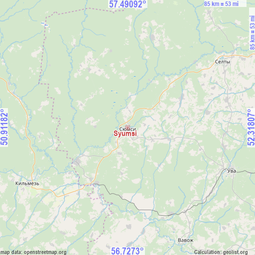
Syumsi GPS coordinates[2]
57° 6' 39.888" North, 51° 36' 53.784" East
| Map corner | latitude | longitude |
|---|---|---|
| Upper-left | 57.49092°, | 50.91182° |
| Center: | 57.11108°, | 51.61494° |
| Lower-right: | 56.7273°, | 52.31807° |
| Map W x H: | 84.9×84.9 km | = 52.8×52.8mi |
| max Lat: | 73.50819° ⇑22% North |
| Syumsi: | 57.11108° |
| min Lat: | ⇓78% South 41.28413° |
| min Long | Syumsi | max Long |
| -179.12198° | 51.61494° | 179.35046° |
| W 63.6%⇐ | ⇒36.4% E |
Elevation
Elevation of Syumsi is 99 m = 325 ft, and this is 103.6 m = 340 ft below average elevation for this country.
| Max E: |
2518 m = 8261 ft | 71.5% |
| Avg. | 202.6 m = 665 ft | |
| Syumsi | 99 m = 325 ft | |
Min E: |
-28 m = -92 ft | 28.5% |
See also: Russia elevation on elevation.city.
Geographical zone
Syumsi is located in North temperate zone (between Tropic of Cancer and the Arctic Circle). Distance of this North polar circle is 1051 km =653.1 mi to North.| Distance of | km | miles | from Syumsi |
|---|---|---|---|
| North Pole | 3656.9 | 2272.3 | to North |
| Arctic Circle | 1051 | 653.1 | to North |
| Tropic Cancer | 3744.2 | 2326.5 | to South |
| Equator | 6350.2 | 3945.8 | to South |


Nearby cities:
15 places around Syumsi: (largest is in red/bold)
• Arkul’
96.5 km =60 mi,  281°
281°
• Bogorodskoye
95.1 km =59.1 mi,  327°
327°
• Kil’mez’
38.1 km =23.7 mi,  240°
240°
• Kizner
93.2 km =57.9 mi,  184°
184°
• Krasnogorskoye
84.6 km =52.6 mi,  38°
38°
• Malmyzh
86.8 km =53.9 mi,  220°
220°
• Mozhga
83 km =51.6 mi,  153°
153°
• Nema
80.1 km =49.8 mi,  303°
303°
• Pychas
84.2 km =52.3 mi,  143°
143°
• Selty
38.5 km =23.9 mi,  54°
54°
• Sosnovka
97.3 km =60.5 mi,  191°
191°
• Uni
71.5 km =44.4 mi,  354°
354°
• Uva
37 km =23 mi,  111°
111°
• Vavozh
42 km =26.1 mi, 152°
• Yukamenskoye
94.2 km =58.5 mi,  23°
23°
Sources, notices
• [Note1] Compared only with cities in Russia existing in our database
• [Src1] Map data: © OpenStreetMap contributors (CC-BY-SA)
• [Src2] Other city data from geonames.org with taken over terms of usage.
• [Src3] Geographical zone / Annual Mean Temperature by Robert A. Rohde @ Wikipedia
