Mozhga geodata
Mozhga (Udmurtiya Republic) is a populated place; located in Russia in Europe/Samara (GMT+4) time zone. With population of 47,270 people, there are 448 cities with bigger population in this country. Compared to other cities in Russia, 72.1% of cities are located further ↓South; 64.1% of cities are located further ←West and 53.1% of cities have lower elevation than Mozhga. Note1


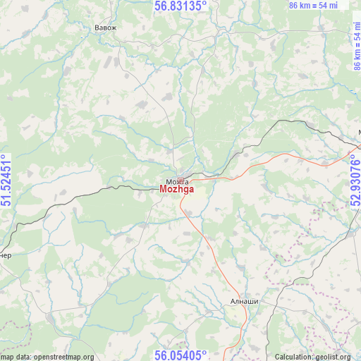
Mozhga GPS coordinates[2]
56° 26' 40.884" North, 52° 13' 39.468" East
| Map corner | latitude | longitude |
|---|---|---|
| Upper-left | 56.83135°, | 51.52451° |
| Center: | 56.44469°, | 52.22763° |
| Lower-right: | 56.05405°, | 52.93076° |
| Map W x H: | 86.4×86.4 km | = 53.7×53.7mi |
| max Lat: | 73.50819° ⇑27.9% North |
| Mozhga: | 56.44469° |
| min Lat: | ⇓72.1% South 41.28413° |
| min Long | Mozhga | max Long |
| -179.12198° | 52.22763° | 179.35046° |
| W 64.1%⇐ | ⇒35.9% E |
Elevation
Elevation of Mozhga is 152 m = 499 ft, and this is 50.6 m = 166 ft below average elevation for this country.
| Max E: |
2518 m = 8261 ft | 46.9% |
| Avg. | 202.6 m = 665 ft | |
| Mozhga | 152 m = 499 ft | |
Min E: |
-28 m = -92 ft | 53.1% |
See also: Mozhga elevation on elevation.city.
Geographical zone
Mozhga is located in North temperate zone (between Tropic of Cancer and the Arctic Circle). Distance of this North polar circle is 1125.1 km =699.1 mi to North.| Distance of | km | miles | from Mozhga |
|---|---|---|---|
| North Pole | 3731 | 2318.3 | to North |
| Arctic Circle | 1125.1 | 699.1 | to North |
| Tropic Cancer | 3670.1 | 2280.5 | to South |
| Equator | 6276.1 | 3899.8 | to South |


Nearby cities:
15 places around Mozhga: (largest is in red/bold)
• Agryz
47.8 km =29.7 mi,  79°
79°
• Alnashi
32.5 km =20.2 mi,  151°
151°
• Grakhovo
46.7 km =29 mi,  200°
200°
• Izhevsk
74.8 km =46.5 mi,  52°
52°
• Kiyasovo
56.2 km =34.9 mi,  100°
100°
• Kizner
48.2 km =30 mi,  246°
246°
• Krasnaya Polyana
70.5 km =43.8 mi, 251°
• Lubyany
68.3 km =42.4 mi,  228°
228°
• Malaya Purga
49.3 km =30.6 mi, 75°
• Mendeleyevsk
59.8 km =37.2 mi,  176°
176°
• Pirogovo
67.6 km =42 mi,  56°
56°
• Pychas
14.6 km =9.1 mi, 63°
• Sosnovka
61.8 km =38.4 mi, 250°
• Uva
60.8 km =37.8 mi,  357°
357°
• Vavozh
41 km =25.5 mi,  333°
333°
Sources, notices
• [Note1] Compared only with cities in Russia existing in our database
• [Src1] Map data: © OpenStreetMap contributors (CC-BY-SA)
• [Src2] Other city data from geonames.org with taken over terms of usage.
• [Src3] Geographical zone / Annual Mean Temperature by Robert A. Rohde @ Wikipedia
