Severnoye geodata
Severnoye (Orenburg Oblast) is a populated place; located in Russia in Asia/Yekaterinburg (GMT+5) time zone. With population of 4,695 people, there are 2785 cities with bigger population in this country. Compared to other cities in Russia, 54.5% of cities are located further ↑North; 64.5% of cities are located further ←West and 69.8% of cities have lower elevation than Severnoye. Note1


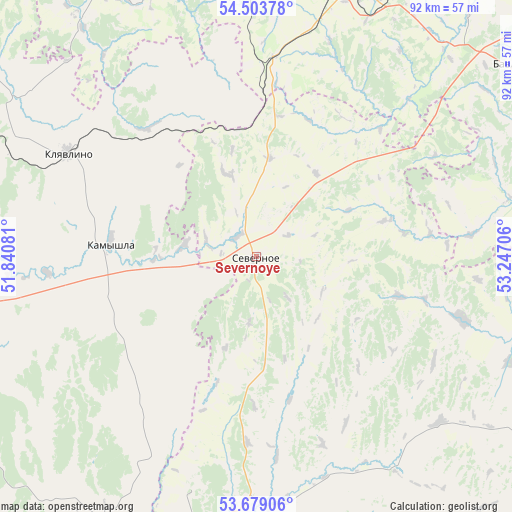
Severnoye GPS coordinates[2]
54° 5' 36.492" North, 52° 32' 38.148" East
| Map corner | latitude | longitude |
|---|---|---|
| Upper-left | 54.50378°, | 51.84081° |
| Center: | 54.09347°, | 52.54393° |
| Lower-right: | 53.67906°, | 53.24706° |
| Map W x H: | 91.7×91.7 km | = 57×57mi |
| max Lat: | 73.50819° ⇑54.5% North |
| Severnoye: | 54.09347° |
| min Lat: | ⇓45.5% South 41.28413° |
| min Long | Severnoye | max Long |
| -179.12198° | 52.54393° | 179.35046° |
| W 64.5%⇐ | ⇒35.5% E |
Elevation
Elevation of Severnoye is 197 m = 646 ft, and this is 5.6 m = 18 ft below average elevation for this country.
| Max E: |
2518 m = 8261 ft | 30.2% |
| Avg. | 202.6 m = 665 ft | |
| Severnoye | 197 m = 646 ft | |
Min E: |
-28 m = -92 ft | 69.8% |
See also: Russia elevation on elevation.city.
Geographical zone
Severnoye is located in North temperate zone (between Tropic of Cancer and the Arctic Circle). Distance of this North polar circle is 1386.5 km =861.5 mi to North.| Distance of | km | miles | from Severnoye |
|---|---|---|---|
| North Pole | 3992.4 | 2480.8 | to North |
| Arctic Circle | 1386.5 | 861.5 | to North |
| Tropic Cancer | 3408.7 | 2118.1 | to South |
| Equator | 6014.6 | 3737.3 | to South |


Nearby cities:
15 places around Severnoye: (largest is in red/bold)
• Asekeyevo
60.1 km =37.3 mi,  163°
163°
• Bavly
57.2 km =35.5 mi,  54°
54°
• Bugul’ma
52.1 km =32.4 mi,  18°
18°
• Buguruslan
49.2 km =30.6 mi,  187°
187°
• Isakly
66 km =41 mi,  273°
273°
• Kamyshla
26.3 km =16.3 mi,  275°
275°
• Karabash
66.7 km =41.4 mi,  2°
2°
• Klyavlino
38.7 km =24 mi,  299°
299°
• Leninogorsk
56.9 km =35.4 mi,  354°
354°
• Nizhnetroitskiy
78.9 km =49 mi,  69°
69°
• Oktyabr’skiy
74 km =46 mi, 54°
• Pokhvistnevo
56.1 km =34.9 mi,  209°
209°
• Shentala
79.5 km =49.4 mi, 299°
• Shugurovo
53.3 km =33.1 mi,  329°
329°
• Yermekeyevo
73.6 km =45.7 mi,  91°
91°
Sources, notices
• [Note1] Compared only with cities in Russia existing in our database
• [Src1] Map data: © OpenStreetMap contributors (CC-BY-SA)
• [Src2] Other city data from geonames.org with taken over terms of usage.
• [Src3] Geographical zone / Annual Mean Temperature by Robert A. Rohde @ Wikipedia
