Segezha geodata
Segezha (Karelia) is a populated place; located in Russia in Europe/Moscow (GMT+3) time zone. With population of 33,354 people, there are 601 cities with bigger population in this country. Compared to other cities in Russia, 96.8% of cities are located further ↓South; 90% of cities are located further →East and 75% of cities have higher elevation than Segezha. Note1


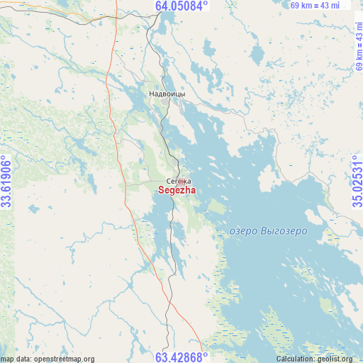
Segezha GPS coordinates[2]
63° 44' 29.292" North, 34° 19' 19.848" East
| Map corner | latitude | longitude |
|---|---|---|
| Upper-left | 64.05084°, | 33.61906° |
| Center: | 63.74147°, | 34.32218° |
| Lower-right: | 63.42868°, | 35.02531° |
| Map W x H: | 69.2×69.2 km | = 43×43mi |
| max Lat: | 73.50819° ⇑3.2% North |
| Segezha: | 63.74147° |
| min Lat: | ⇓96.8% South 41.28413° |
| min Long | Segezha | max Long |
| -179.12198° | 34.32218° | 179.35046° |
| W 10%⇐ | ⇒90% E |
Elevation
Elevation of Segezha is 88 m = 289 ft, and this is 114.6 m = 376 ft below average elevation for this country.
| Max E: |
2518 m = 8261 ft | 75% |
| Avg. | 202.6 m = 665 ft | |
| Segezha | 88 m = 289 ft | |
Min E: |
-28 m = -92 ft | 25% |
See also: Russia elevation on elevation.city.
Geographical zone
Segezha is located in North temperate zone (between Tropic of Cancer and the Arctic Circle). Distance of this North polar circle is 313.8 km =195 mi to North.| Distance of | km | miles | from Segezha |
|---|---|---|---|
| North Pole | 2919.7 | 1814.2 | to North |
| Arctic Circle | 313.8 | 195 | to North |
| Tropic Cancer | 4481.5 | 2784.7 | to South |
| Equator | 7087.4 | 4403.9 | to South |


Nearby cities:
15 places around Segezha: (largest is in red/bold)
• Belomorsk
89.6 km =55.7 mi,  13°
13°
• Borovoy
139.4 km =86.6 mi,  313°
313°
• Gimoly
126.7 km =78.7 mi,  232°
232°
• Girvas
143.9 km =89.4 mi,  192°
192°
• Kem’
135.5 km =84.2 mi, 5°
• Ledmozero
125.5 km =78 mi,  297°
297°
• Medvezh’yegorsk
91.9 km =57.1 mi,  175°
175°
• Muyezerskiy
116.9 km =72.6 mi,  281°
281°
• Nadvoitsy
13.9 km =8.6 mi,  358°
358°
• Pindushi
92.8 km =57.7 mi,  172°
172°
• Porosozero
138.9 km =86.3 mi,  215°
215°
• Povenets
102.4 km =63.6 mi, 165°
• Rabocheostrovsk
140 km =87 mi, 8°
• Shun’ga
130.4 km =81 mi, 166°
• Sukkozero
117 km =72.7 mi,  237°
237°
Sources, notices
• [Note1] Compared only with cities in Russia existing in our database
• [Src1] Map data: © OpenStreetMap contributors (CC-BY-SA)
• [Src2] Other city data from geonames.org with taken over terms of usage.
• [Src3] Geographical zone / Annual Mean Temperature by Robert A. Rohde @ Wikipedia
