Muyezerskiy geodata
Muyezerskiy (Karelia) is a populated place; located in Russia in Europe/Moscow (GMT+3) time zone. With population of 3,901 people, there are 3170 cities with bigger population in this country. Compared to other cities in Russia, 96.9% of cities are located further ↓South; 93.6% of cities are located further →East and 55.3% of cities have lower elevation than Muyezerskiy. Note1


Muyezerskiy GPS coordinates[2]
63° 57' 27.288" North, 31° 59' 14.568" East
| Map corner | latitude | longitude |
|---|---|---|
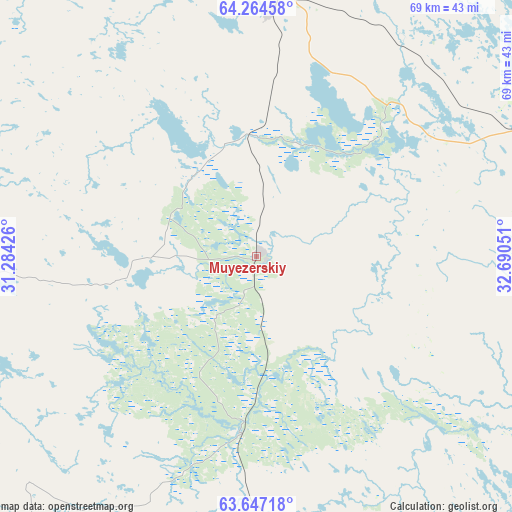
| Upper-left | 64.26458°, | 31.28426° |
| Center: | 63.95758°, | 31.98738° |
| Lower-right: | 63.64718°, | 32.69051° |
| Map W x H: | 68.6×68.6 km | = 42.6×42.6mi |
| max Lat: | 73.50819° ⇑3.1% North |
| Muyezerskiy: | 63.95758° |
| min Lat: | ⇓96.9% South 41.28413° |
| min Long | Muyezerskiy | max Long |
| -179.12198° | 31.98738° | 179.35046° |
| W 6.4%⇐ | ⇒93.6% E |
Elevation
Elevation of Muyezerskiy is 157 m = 515 ft, and this is 45.6 m = 150 ft below average elevation for this country.
| Max E: |
2518 m = 8261 ft | 44.7% |
| Avg. | 202.6 m = 665 ft | |
| Muyezerskiy | 157 m = 515 ft | |
Min E: |
-28 m = -92 ft | 55.3% |
See also: Russia elevation on elevation.city.
Geographical zone
Muyezerskiy is located in North temperate zone (between Tropic of Cancer and the Arctic Circle). Distance of this North polar circle is 289.8 km =180.1 mi to North.| Distance of | km | miles | from Muyezerskiy |
|---|---|---|---|
| North Pole | 2895.6 | 1799.2 | to North |
| Arctic Circle | 289.8 | 180.1 | to North |
| Tropic Cancer | 4505.5 | 2799.6 | to South |
| Equator | 7111.4 | 4418.8 | to South |


Nearby cities:
15 places around Muyezerskiy: (largest is in red/bold)
• Belomorsk
148.3 km =92.1 mi,  64°
64°
• Borovoy
73.9 km =45.9 mi,  9°
9°
• Gimoly
103.3 km =64.2 mi,  170°
170°
• Kalevala
143.2 km =89 mi,  344°
344°
• Kem’
166.6 km =103.5 mi,  48°
48°
• Kostomuksha
96.4 km =59.9 mi,  315°
315°
• Ledmozero
33.1 km =20.6 mi,  3°
3°
• Medvezh’yegorsk
168.7 km =104.8 mi,  133°
133°
• Nadvoitsy
114.3 km =71 mi,  95°
95°
• Pindushi
173.3 km =107.7 mi, 131°
• Porosozero
142.6 km =88.6 mi, 165°
• Rabocheostrovsk
175.4 km =109 mi, 49°
• Segezha
116.9 km =72.6 mi, 101°
• Sukkozero
89.3 km =55.5 mi, 168°
• Yushkozero
88.5 km =55 mi, 3°
Sources, notices
• [Note1] Compared only with cities in Russia existing in our database
• [Src1] Map data: © OpenStreetMap contributors (CC-BY-SA)
• [Src2] Other city data from geonames.org with taken over terms of usage.
• [Src3] Geographical zone / Annual Mean Temperature by Robert A. Rohde @ Wikipedia
