Pestravka geodata
Pestravka (Samara Oblast) is a populated place; located in Russia in Europe/Samara (GMT+4) time zone. With population of 6,623 people, there are 2094 cities with bigger population in this country. Compared to other cities in Russia, 66.9% of cities are located further ↑North; 61.9% of cities are located further ←West and 86.3% of cities have higher elevation than Pestravka. Note1


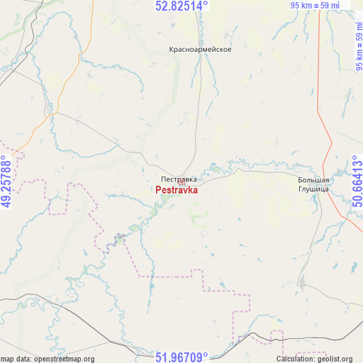
Pestravka GPS coordinates[2]
52° 23' 53.52" North, 49° 57' 39.6" East
| Map corner | latitude | longitude |
|---|---|---|
| Upper-left | 52.82514°, | 49.25788° |
| Center: | 52.3982°, | 49.961° |
| Lower-right: | 51.96709°, | 50.66413° |
| Map W x H: | 95.4×95.4 km | = 59.3×59.3mi |
| max Lat: | 73.50819° ⇑66.9% North |
| Pestravka: | 52.3982° |
| min Lat: | ⇓33.1% South 41.28413° |
| min Long | Pestravka | max Long |
| -179.12198° | 49.961° | 179.35046° |
| W 61.9%⇐ | ⇒38.1% E |
Elevation
Elevation of Pestravka is 42 m = 138 ft, and this is 160.6 m = 527 ft below average elevation for this country.
| Max E: |
2518 m = 8261 ft | 86.3% |
| Avg. | 202.6 m = 665 ft | |
| Pestravka | 42 m = 138 ft | |
Min E: |
-28 m = -92 ft | 13.7% |
See also: Russia elevation on elevation.city.
Geographical zone
Pestravka is located in North temperate zone (between Tropic of Cancer and the Arctic Circle). Distance of this North polar circle is 1575 km =978.7 mi to North.| Distance of | km | miles | from Pestravka |
|---|---|---|---|
| North Pole | 4180.9 | 2597.9 | to North |
| Arctic Circle | 1575 | 978.7 | to North |
| Tropic Cancer | 3220.2 | 2000.9 | to South |
| Equator | 5826.1 | 3620.2 | to South |


Nearby cities:
15 places around Pestravka: (largest is in red/bold)
• Bezenchuk
74 km =46 mi,  331°
331°
• Chapayevsk
66.6 km =41.4 mi,  345°
345°
• Dubovyy Umët
67.9 km =42.2 mi,  18°
18°
• Ivanteyevka
59.9 km =37.2 mi,  255°
255°
• Khvorostyanka
71.7 km =44.6 mi,  289°
289°
• Krasnoarmeyskoye
36.1 km =22.4 mi,  7°
7°
• Mayskoye
14.8 km =9.2 mi,  160°
160°
• Novokuybyshevsk
77.6 km =48.2 mi,  359°
359°
• Osinki
58 km =36 mi, 328°
• Perelyub
65.3 km =40.6 mi, 155°
• Pugachev
89.8 km =55.8 mi,  241°
241°
• Roschinskiy
81.1 km =50.4 mi,  26°
26°
• Samara
90.1 km =56 mi, 8°
• Spiridonovka
89.9 km =55.9 mi, 30°
• Utevka
87.2 km =54.2 mi,  49°
49°
Sources, notices
• [Note1] Compared only with cities in Russia existing in our database
• [Src1] Map data: © OpenStreetMap contributors (CC-BY-SA)
• [Src2] Other city data from geonames.org with taken over terms of usage.
• [Src3] Geographical zone / Annual Mean Temperature by Robert A. Rohde @ Wikipedia
