Yushkozero geodata
Yushkozero (Karelia) is a populated place; located in Russia in Europe/Moscow (GMT+3) time zone. With population of 1,300 people, there are 4471 cities with bigger population in this country. Compared to other cities in Russia, 97.5% of cities are located further ↓South; 93.3% of cities are located further →East and 68.8% of cities have higher elevation than Yushkozero. Note1


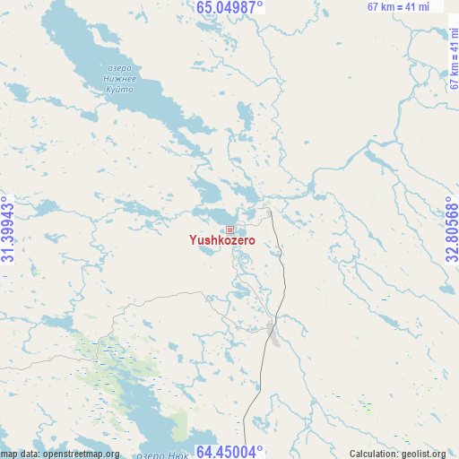
Yushkozero GPS coordinates[2]
64° 45' 5.832" North, 32° 6' 9.18" East
| Map corner | latitude | longitude |
|---|---|---|
| Upper-left | 65.04987°, | 31.39943° |
| Center: | 64.75162°, | 32.10255° |
| Lower-right: | 64.45004°, | 32.80568° |
| Map W x H: | 66.7×66.7 km | = 41.4×41.4mi |
| max Lat: | 73.50819° ⇑2.5% North |
| Yushkozero: | 64.75162° |
| min Lat: | ⇓97.5% South 41.28413° |
| min Long | Yushkozero | max Long |
| -179.12198° | 32.10255° | 179.35046° |
| W 6.7%⇐ | ⇒93.3% E |
Elevation
Elevation of Yushkozero is 105 m = 344 ft, and this is 97.6 m = 320 ft below average elevation for this country.
| Max E: |
2518 m = 8261 ft | 68.8% |
| Avg. | 202.6 m = 665 ft | |
| Yushkozero | 105 m = 344 ft | |
Min E: |
-28 m = -92 ft | 31.2% |
See also: Russia elevation on elevation.city.
Geographical zone
Yushkozero is located in North temperate zone (between Tropic of Cancer and the Arctic Circle). Distance of this North polar circle is 201.5 km =125.2 mi to North.| Distance of | km | miles | from Yushkozero |
|---|---|---|---|
| North Pole | 2807.4 | 1744.4 | to North |
| Arctic Circle | 201.5 | 125.2 | to North |
| Tropic Cancer | 4593.8 | 2854.5 | to South |
| Equator | 7199.7 | 4473.7 | to South |


Nearby cities:
15 places around Yushkozero: (largest is in red/bold)
• Ambarnyy
147.9 km =91.9 mi,  30°
30°
• Belomorsk
129.4 km =80.4 mi,  101°
101°
• Borovoy
17 km =10.6 mi,  155°
155°
• Engozero
143.3 km =89 mi,  36°
36°
• Kalevala
65.7 km =40.8 mi,  319°
319°
• Kem’
119.2 km =74.1 mi,  79°
79°
• Kostomuksha
75.3 km =46.8 mi,  254°
254°
• Ledmozero
55.4 km =34.4 mi,  183°
183°
• Loukhi
153.6 km =95.4 mi,  16°
16°
• Muyezerskiy
88.5 km =55 mi, 183°
• Nadvoitsy
145.1 km =90.2 mi,  132°
132°
• Pyaozerskiy
122.5 km =76.1 mi,  337°
337°
• Rabocheostrovsk
128.4 km =79.8 mi, 78°
• Segezha
155.3 km =96.5 mi,  136°
136°
• Solovetsky
172.9 km =107.4 mi, 79°
Sources, notices
• [Note1] Compared only with cities in Russia existing in our database
• [Src1] Map data: © OpenStreetMap contributors (CC-BY-SA)
• [Src2] Other city data from geonames.org with taken over terms of usage.
• [Src3] Geographical zone / Annual Mean Temperature by Robert A. Rohde @ Wikipedia
