Milyutinskaya geodata
Milyutinskaya (Rostov) is a seat of a second-order administrative division; located in Russia in Europe/Moscow (GMT+3) time zone. With population of 2,743 people, there are 3877 cities with bigger population in this country. Compared to other cities in Russia, 79.6% of cities are located further ↑North; 61% of cities are located further →East and 74.4% of cities have higher elevation than Milyutinskaya. Note1


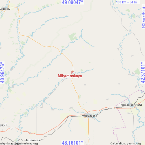
Milyutinskaya GPS coordinates[2]
48° 37' 40.368" North, 41° 40' 4.368" East
| Map corner | latitude | longitude |
|---|---|---|
| Upper-left | 49.09047°, | 40.96476° |
| Center: | 48.62788°, | 41.66788° |
| Lower-right: | 48.16101°, | 42.37101° |
| Map W x H: | 103.3×103.3 km | = 64.2×64.2mi |
| max Lat: | 73.50819° ⇑79.6% North |
| Milyutinskaya: | 48.62788° |
| min Lat: | ⇓20.4% South 41.28413° |
| min Long | Milyutinskaya | max Long |
| -179.12198° | 41.66788° | 179.35046° |
| W 39%⇐ | ⇒61% E |
Elevation
Elevation of Milyutinskaya is 90 m = 295 ft, and this is 112.6 m = 369 ft below average elevation for this country.
| Max E: |
2518 m = 8261 ft | 74.4% |
| Avg. | 202.6 m = 665 ft | |
| Milyutinskaya | 90 m = 295 ft | |
Min E: |
-28 m = -92 ft | 25.6% |
See also: Russia elevation on elevation.city.
Geographical zone
Milyutinskaya is located in North temperate zone (between Tropic of Cancer and the Arctic Circle). Distance of this North polar circle is 1994.3 km =1239.2 mi to North.| Distance of | km | miles | from Milyutinskaya |
|---|---|---|---|
| North Pole | 4600.1 | 2858.4 | to North |
| Arctic Circle | 1994.3 | 1239.2 | to North |
| Tropic Cancer | 2801 | 1740.5 | to South |
| Equator | 5406.9 | 3359.7 | to South |


Nearby cities:
15 places around Milyutinskaya: (largest is in red/bold)
• Belaya Kalitva
82.3 km =51.1 mi,  233°
233°
• Bokovskaya
67.9 km =42.2 mi,  10°
10°
• Bystrogorskiy
60.7 km =37.7 mi,  219°
219°
• Chernyshkovskiy
47.4 km =29.5 mi,  118°
118°
• Gornyatskiy
66.1 km =41.1 mi,  236°
236°
• Kashary
66.7 km =41.4 mi,  313°
313°
• Koksovyy
89.5 km =55.6 mi, 237°
• Morozovsk
32.5 km =20.2 mi,  158°
158°
• Oblivskaya
62.2 km =38.6 mi,  99°
99°
• Sholokhovskiy
59.9 km =37.2 mi, 229°
• Sovetskaya
53.9 km =33.5 mi,  38°
38°
• Surovikino
86.6 km =53.8 mi,  91°
91°
• Tatsinskiy
56 km =34.8 mi,  211°
211°
• Uglegorskiy
52.6 km =32.7 mi, 215°
• Zhirnov
64.7 km =40.2 mi, 218°
Sources, notices
• [Note1] Compared only with cities in Russia existing in our database
• [Src1] Map data: © OpenStreetMap contributors (CC-BY-SA)
• [Src2] Other city data from geonames.org with taken over terms of usage.
• [Src3] Geographical zone / Annual Mean Temperature by Robert A. Rohde @ Wikipedia
