Bokovskaya geodata
Bokovskaya (Rostov) is a seat of a second-order administrative division; located in Russia in Europe/Moscow (GMT+3) time zone. With population of 5,032 people, there are 2645 cities with bigger population in this country. Compared to other cities in Russia, 78.7% of cities are located further ↑North; 60.4% of cities are located further →East and 72.9% of cities have higher elevation than Bokovskaya. Note1


Bokovskaya GPS coordinates[2]
49° 13' 44.364" North, 41° 49' 50.16" East
| Map corner | latitude | longitude |
|---|---|---|
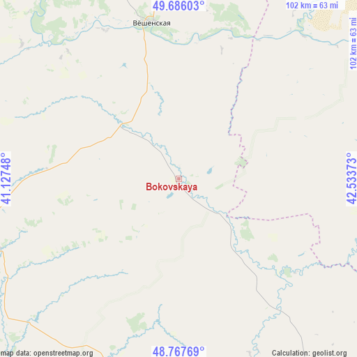
| Upper-left | 49.68603°, | 41.12748° |
| Center: | 49.22899°, | 41.8306° |
| Lower-right: | 48.76769°, | 42.53373° |
| Map W x H: | 102.1×102.1 km | = 63.4×63.4mi |
| max Lat: | 73.50819° ⇑78.7% North |
| Bokovskaya: | 49.22899° |
| min Lat: | ⇓21.3% South 41.28413° |
| min Long | Bokovskaya | max Long |
| -179.12198° | 41.8306° | 179.35046° |
| W 39.6%⇐ | ⇒60.4% E |
Elevation
Elevation of Bokovskaya is 94 m = 308 ft, and this is 108.6 m = 356 ft below average elevation for this country.
| Max E: |
2518 m = 8261 ft | 72.9% |
| Avg. | 202.6 m = 665 ft | |
| Bokovskaya | 94 m = 308 ft | |
Min E: |
-28 m = -92 ft | 27.1% |
See also: Russia elevation on elevation.city.
Geographical zone
Bokovskaya is located in North temperate zone (between Tropic of Cancer and the Arctic Circle). Distance of this North polar circle is 1927.4 km =1197.6 mi to North.| Distance of | km | miles | from Bokovskaya |
|---|---|---|---|
| North Pole | 4533.3 | 2816.9 | to North |
| Arctic Circle | 1927.4 | 1197.6 | to North |
| Tropic Cancer | 2867.8 | 1782 | to South |
| Equator | 5473.8 | 3401.3 | to South |


Nearby cities:
15 places around Bokovskaya: (largest is in red/bold)
• Chernyshkovskiy
94.4 km =58.7 mi,  161°
161°
• Kashary
63.6 km =39.5 mi,  250°
250°
• Kazanskaya
79.8 km =49.6 mi,  321°
321°
• Kletskaya
89.6 km =55.7 mi,  83°
83°
• Kumylzhenskaya
90.8 km =56.4 mi,  37°
37°
• Millerovo
109.8 km =68.2 mi, 251°
• Milyutinskaya
67.9 km =42.2 mi,  190°
190°
• Morozovsk
97.2 km =60.4 mi,  180°
180°
• Oblivskaya
91.3 km =56.7 mi,  147°
147°
• Serafimovich
76.2 km =47.3 mi,  59°
59°
• Slashchevskaya
79.1 km =49.2 mi,  27°
27°
• Sovetskaya
32.4 km =20.1 mi,  139°
139°
• Surovikino
101.4 km =63 mi,  132°
132°
• Uglegorskiy
117.6 km =73.1 mi,  201°
201°
• Veshenskaya
45.2 km =28.1 mi,  351°
351°
Sources, notices
• [Note1] Compared only with cities in Russia existing in our database
• [Src1] Map data: © OpenStreetMap contributors (CC-BY-SA)
• [Src2] Other city data from geonames.org with taken over terms of usage.
• [Src3] Geographical zone / Annual Mean Temperature by Robert A. Rohde @ Wikipedia
