Tatsinskiy geodata
Tatsinskiy (Rostov) is a populated place; located in Russia in Europe/Moscow (GMT+3) time zone. With population of 11,258 people, there are 1342 cities with bigger population in this country. Compared to other cities in Russia, 80.3% of cities are located further ↑North; 62.1% of cities are located further →East and 76.7% of cities have higher elevation than Tatsinskiy. Note1


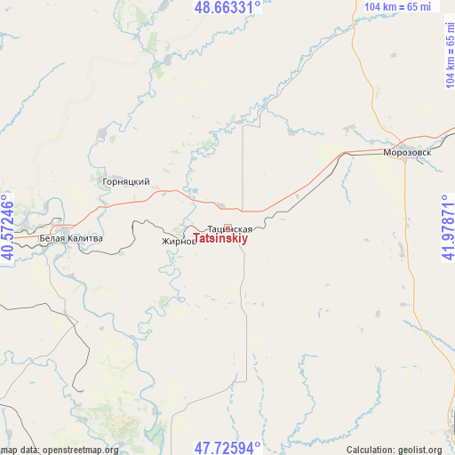
Tatsinskiy GPS coordinates[2]
48° 11' 48.372" North, 41° 16' 32.088" East
| Map corner | latitude | longitude |
|---|---|---|
| Upper-left | 48.66331°, | 40.57246° |
| Center: | 48.19677°, | 41.27558° |
| Lower-right: | 47.72594°, | 41.97871° |
| Map W x H: | 104.2×104.2 km | = 64.7×64.7mi |
| max Lat: | 73.50819° ⇑80.3% North |
| Tatsinskiy: | 48.19677° |
| min Lat: | ⇓19.7% South 41.28413° |
| min Long | Tatsinskiy | max Long |
| -179.12198° | 41.27558° | 179.35046° |
| W 37.9%⇐ | ⇒62.1% E |
Elevation
Elevation of Tatsinskiy is 82 m = 269 ft, and this is 120.6 m = 396 ft below average elevation for this country.
| Max E: |
2518 m = 8261 ft | 76.7% |
| Avg. | 202.6 m = 665 ft | |
| Tatsinskiy | 82 m = 269 ft | |
Min E: |
-28 m = -92 ft | 23.3% |
See also: Russia elevation on elevation.city.
Geographical zone
Tatsinskiy is located in North temperate zone (between Tropic of Cancer and the Arctic Circle). Distance of this North polar circle is 2042.2 km =1269 mi to North.| Distance of | km | miles | from Tatsinskiy |
|---|---|---|---|
| North Pole | 4648.1 | 2888.2 | to North |
| Arctic Circle | 2042.2 | 1269 | to North |
| Tropic Cancer | 2753.1 | 1710.7 | to South |
| Equator | 5359 | 3329.9 | to South |


Nearby cities:
15 places around Tatsinskiy: (largest is in red/bold)
• Belaya Kalitva
37.2 km =23.1 mi,  268°
268°
• Bystrogorskiy
10.1 km =6.3 mi,  277°
277°
• Chernyshkovskiy
74.9 km =46.5 mi,  70°
70°
• Gornyatskiy
28.3 km =17.6 mi,  293°
293°
• Koksovyy
46.9 km =29.1 mi, 270°
• Konstantinovsk
69.6 km =43.2 mi,  191°
191°
• Milyutinskaya
56 km =34.8 mi,  31°
31°
• Morozovsk
44.4 km =27.6 mi, 66°
• Nikolayevskaya
67 km =41.6 mi,  165°
165°
• Sholokhovskiy
19.4 km =12.1 mi,  298°
298°
• Sinegorskiy
37.9 km =23.5 mi,  237°
237°
• Staraya Stanitsa
74.5 km =46.3 mi, 282°
• Uglegorskiy
5.4 km =3.4 mi,  341°
341°
• Ust’-Donetskiy
68.6 km =42.6 mi,  205°
205°
• Zhirnov
11.5 km =7.1 mi,  255°
255°
Sources, notices
• [Note1] Compared only with cities in Russia existing in our database
• [Src1] Map data: © OpenStreetMap contributors (CC-BY-SA)
• [Src2] Other city data from geonames.org with taken over terms of usage.
• [Src3] Geographical zone / Annual Mean Temperature by Robert A. Rohde @ Wikipedia
