Oblivskaya geodata
Oblivskaya (Rostov) is a seat of a second-order administrative division; located in Russia in Europe/Moscow (GMT+3) time zone. With population of 9,528 people, there are 1587 cities with bigger population in this country. Compared to other cities in Russia, 79.7% of cities are located further ↑North; 58.3% of cities are located further →East and 82.8% of cities have higher elevation than Oblivskaya. Note1


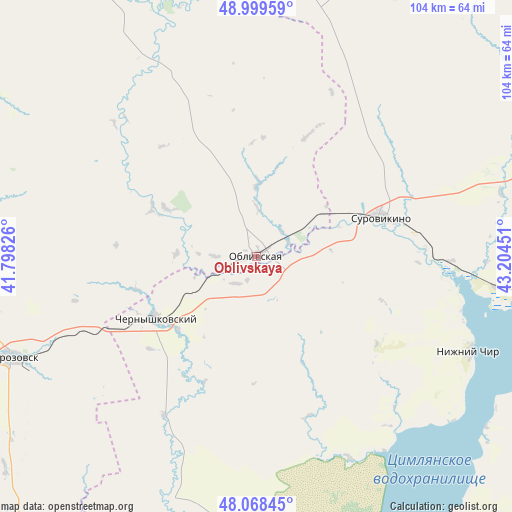
Oblivskaya GPS coordinates[2]
48° 32' 10.176" North, 42° 30' 4.968" East
| Map corner | latitude | longitude |
|---|---|---|
| Upper-left | 48.99959°, | 41.79826° |
| Center: | 48.53616°, | 42.50138° |
| Lower-right: | 48.06845°, | 43.20451° |
| Map W x H: | 103.5×103.5 km | = 64.3×64.3mi |
| max Lat: | 73.50819° ⇑79.7% North |
| Oblivskaya: | 48.53616° |
| min Lat: | ⇓20.3% South 41.28413° |
| min Long | Oblivskaya | max Long |
| -179.12198° | 42.50138° | 179.35046° |
| W 41.7%⇐ | ⇒58.3% E |
Elevation
Elevation of Oblivskaya is 59 m = 194 ft, and this is 143.6 m = 471 ft below average elevation for this country.
| Max E: |
2518 m = 8261 ft | 82.8% |
| Avg. | 202.6 m = 665 ft | |
| Oblivskaya | 59 m = 194 ft | |
Min E: |
-28 m = -92 ft | 17.2% |
See also: Russia elevation on elevation.city.
Geographical zone
Oblivskaya is located in North temperate zone (between Tropic of Cancer and the Arctic Circle). Distance of this North polar circle is 2004.5 km =1245.5 mi to North.| Distance of | km | miles | from Oblivskaya |
|---|---|---|---|
| North Pole | 4610.3 | 2864.7 | to North |
| Arctic Circle | 2004.5 | 1245.5 | to North |
| Tropic Cancer | 2790.8 | 1734.1 | to South |
| Equator | 5396.7 | 3353.4 | to South |


Nearby cities:
15 places around Oblivskaya: (largest is in red/bold)
• Bokovskaya
91.3 km =56.7 mi,  327°
327°
• Bystrogorskiy
106.9 km =66.4 mi,  250°
250°
• Chernyshkovskiy
23.6 km =14.7 mi,  237°
237°
• Kalach-na-Donu
77.3 km =48 mi,  77°
77°
• Kletskaya
95.6 km =59.4 mi,  25°
25°
• Krasnoyarskaya
104.2 km =64.7 mi,  199°
199°
• Milyutinskaya
62.2 km =38.6 mi,  279°
279°
• Morozovsk
53.7 km =33.4 mi, 247°
• Nizhniy Chir
47.4 km =29.5 mi,  114°
114°
• Oktyabr’skiy
96.7 km =60.1 mi, 82°
• Sovetskaya
59.5 km =37 mi, 332°
• Surovikino
26.6 km =16.5 mi,  72°
72°
• Tatsinskiy
98.1 km =61 mi, 247°
• Tsimlyansk
103.3 km =64.2 mi, 196°
• Uglegorskiy
97.8 km =60.8 mi, 250°
Sources, notices
• [Note1] Compared only with cities in Russia existing in our database
• [Src1] Map data: © OpenStreetMap contributors (CC-BY-SA)
• [Src2] Other city data from geonames.org with taken over terms of usage.
• [Src3] Geographical zone / Annual Mean Temperature by Robert A. Rohde @ Wikipedia
