Chernyshkovskiy geodata
Chernyshkovskiy (Volgograd Oblast) is a populated place; located in Russia in Europe/Volgograd (GMT+3) time zone. With population of 5,458 people, there are 2453 cities with bigger population in this country. Compared to other cities in Russia, 79.9% of cities are located further ↑North; 58.9% of cities are located further →East and 78.4% of cities have higher elevation than Chernyshkovskiy. Note1


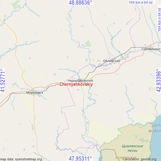
Chernyshkovskiy GPS coordinates[2]
48° 25' 18.768" North, 42° 13' 50.988" East
| Map corner | latitude | longitude |
|---|---|---|
| Upper-left | 48.88636°, | 41.52771° |
| Center: | 48.42188°, | 42.23083° |
| Lower-right: | 47.95311°, | 42.93396° |
| Map W x H: | 103.8×103.8 km | = 64.5×64.5mi |
| max Lat: | 73.50819° ⇑79.9% North |
| Chernyshkovskiy: | 48.42188° |
| min Lat: | ⇓20.1% South 41.28413° |
| min Long | Chernyshkovskiy | max Long |
| -179.12198° | 42.23083° | 179.35046° |
| W 41.1%⇐ | ⇒58.9% E |
Elevation
Elevation of Chernyshkovskiy is 76 m = 249 ft, and this is 126.6 m = 415 ft below average elevation for this country.
| Max E: |
2518 m = 8261 ft | 78.4% |
| Avg. | 202.6 m = 665 ft | |
| Chernyshkovskiy | 76 m = 249 ft | |
Min E: |
-28 m = -92 ft | 21.6% |
See also: Russia elevation on elevation.city.
Geographical zone
Chernyshkovskiy is located in North temperate zone (between Tropic of Cancer and the Arctic Circle). Distance of this North polar circle is 2017.2 km =1253.4 mi to North.| Distance of | km | miles | from Chernyshkovskiy |
|---|---|---|---|
| North Pole | 4623.1 | 2872.7 | to North |
| Arctic Circle | 2017.2 | 1253.4 | to North |
| Tropic Cancer | 2778.1 | 1726.2 | to South |
| Equator | 5384 | 3345.5 | to South |


Nearby cities:
15 places around Chernyshkovskiy: (largest is in red/bold)
• Bokovskaya
94.4 km =58.7 mi,  341°
341°
• Bystrogorskiy
84 km =52.2 mi,  253°
253°
• Gornyatskiy
97.5 km =60.6 mi,  261°
261°
• Krasnoyarskaya
86.9 km =54 mi,  189°
189°
• Milyutinskaya
47.4 km =29.5 mi,  298°
298°
• Morozovsk
30.8 km =19.1 mi, 256°
• Nizhniy Chir
63.6 km =39.5 mi,  96°
96°
• Oblivskaya
23.6 km =14.7 mi,  57°
57°
• Sholokhovskiy
89 km =55.3 mi, 259°
• Sovetskaya
65.8 km =40.9 mi,  353°
353°
• Surovikino
49.8 km =30.9 mi,  65°
65°
• Tatsinskiy
74.9 km =46.5 mi, 250°
• Tsimlyansk
86.8 km =53.9 mi, 186°
• Uglegorskiy
75 km =46.6 mi, 254°
• Zhirnov
86.4 km =53.7 mi, 251°
Sources, notices
• [Note1] Compared only with cities in Russia existing in our database
• [Src1] Map data: © OpenStreetMap contributors (CC-BY-SA)
• [Src2] Other city data from geonames.org with taken over terms of usage.
• [Src3] Geographical zone / Annual Mean Temperature by Robert A. Rohde @ Wikipedia
