Uglegorskiy geodata
Uglegorskiy (Rostov) is a populated place; located in Russia in Europe/Moscow (GMT+3) time zone. With population of 2,485 people, there are 3961 cities with bigger population in this country. Compared to other cities in Russia, 80.2% of cities are located further ↑North; 62.2% of cities are located further →East and 66.6% of cities have higher elevation than Uglegorskiy. Note1


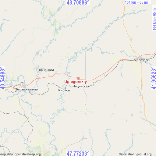
Uglegorskiy GPS coordinates[2]
48° 14' 33.864" North, 41° 15' 11.16" East
| Map corner | latitude | longitude |
|---|---|---|
| Upper-left | 48.70886°, | 40.54998° |
| Center: | 48.24274°, | 41.2531° |
| Lower-right: | 47.77233°, | 41.95623° |
| Map W x H: | 104.1×104.1 km | = 64.7×64.7mi |
| max Lat: | 73.50819° ⇑80.2% North |
| Uglegorskiy: | 48.24274° |
| min Lat: | ⇓19.8% South 41.28413° |
| min Long | Uglegorskiy | max Long |
| -179.12198° | 41.2531° | 179.35046° |
| W 37.8%⇐ | ⇒62.2% E |
Elevation
Elevation of Uglegorskiy is 110 m = 361 ft, and this is 92.6 m = 304 ft below average elevation for this country.
| Max E: |
2518 m = 8261 ft | 66.6% |
| Avg. | 202.6 m = 665 ft | |
| Uglegorskiy | 110 m = 361 ft | |
Min E: |
-28 m = -92 ft | 33.4% |
See also: Russia elevation on elevation.city.
Geographical zone
Uglegorskiy is located in North temperate zone (between Tropic of Cancer and the Arctic Circle). Distance of this North polar circle is 2037.1 km =1265.8 mi to North.| Distance of | km | miles | from Uglegorskiy |
|---|---|---|---|
| North Pole | 4643 | 2885 | to North |
| Arctic Circle | 2037.1 | 1265.8 | to North |
| Tropic Cancer | 2758.2 | 1713.9 | to South |
| Equator | 5364.1 | 3333.1 | to South |


Nearby cities:
15 places around Uglegorskiy: (largest is in red/bold)
• Belaya Kalitva
36 km =22.4 mi,  259°
259°
• Bystrogorskiy
9.2 km =5.7 mi,  245°
245°
• Gornyatskiy
25.1 km =15.6 mi,  283°
283°
• Kamensk-Shakhtinskiy
74 km =46 mi, 276°
• Koksovyy
45.5 km =28.3 mi, 263°
• Konstantinovsk
74.4 km =46.2 mi,  189°
189°
• Milyutinskaya
52.6 km =32.7 mi,  35°
35°
• Morozovsk
44.2 km =27.5 mi,  73°
73°
• Nikolayevskaya
72.3 km =44.9 mi,  165°
165°
• Sholokhovskiy
15.9 km =9.9 mi,  285°
285°
• Sinegorskiy
39.6 km =24.6 mi,  229°
229°
• Staraya Stanitsa
71.9 km =44.7 mi, 279°
• Tatsinskiy
5.4 km =3.4 mi,  161°
161°
• Ust’-Donetskiy
72.6 km =45.1 mi,  203°
203°
• Zhirnov
12.3 km =7.6 mi, 229°
Sources, notices
• [Note1] Compared only with cities in Russia existing in our database
• [Src1] Map data: © OpenStreetMap contributors (CC-BY-SA)
• [Src2] Other city data from geonames.org with taken over terms of usage.
• [Src3] Geographical zone / Annual Mean Temperature by Robert A. Rohde @ Wikipedia
