Urozhaynoye geodata
Urozhaynoye (Stavropol’ Kray) is a populated place; located in Russia in Europe/Moscow (GMT+3) time zone. With population of 4,215 people, there are 2989 cities with bigger population in this country. Compared to other cities in Russia, 88.3% of cities are located further ↑North; 50.1% of cities are located further →East and 84.9% of cities have higher elevation than Urozhaynoye. Note1


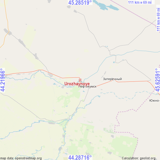
Urozhaynoye GPS coordinates[2]
44° 47' 17.988" North, 44° 55' 22.008" East
| Map corner | latitude | longitude |
|---|---|---|
| Upper-left | 45.28519°, | 44.21966° |
| Center: | 44.78833°, | 44.92278° |
| Lower-right: | 44.28716°, | 45.62591° |
| Map W x H: | 111×111 km | = 69×69mi |
| max Lat: | 73.50819° ⇑88.3% North |
| Urozhaynoye: | 44.78833° |
| min Lat: | ⇓11.7% South 41.28413° |
| min Long | Urozhaynoye | max Long |
| -179.12198° | 44.92278° | 179.35046° |
| W 49.9%⇐ | ⇒50.1% E |
Elevation
Elevation of Urozhaynoye is 48 m = 157 ft, and this is 154.6 m = 507 ft below average elevation for this country.
| Max E: |
2518 m = 8261 ft | 84.9% |
| Avg. | 202.6 m = 665 ft | |
| Urozhaynoye | 48 m = 157 ft | |
Min E: |
-28 m = -92 ft | 15.1% |
See also: Russia elevation on elevation.city.
Geographical zone
Urozhaynoye is located in North temperate zone (between Tropic of Cancer and the Arctic Circle). Distance of this Northern Tropic circle is 2374.1 km =1475.2 mi to South.| Distance of | km | miles | from Urozhaynoye |
|---|---|---|---|
| North Pole | 5027.1 | 3123.7 | to North |
| Arctic Circle | 2421.2 | 1504.5 | to North |
| Tropic Cancer | 2374.1 | 1475.2 | to South |
| Equator | 4980 | 3094.4 | to South |


Nearby cities:
15 places around Urozhaynoye: (largest is in red/bold)
• Achikulak
27.2 km =16.9 mi,  194°
194°
• Budënnovsk
59.7 km =37.1 mi,  269°
269°
• Irgakly
49.3 km =30.6 mi,  195°
195°
• Kara-Tyube
44.1 km =27.4 mi,  112°
112°
• Kayasula
51.9 km =32.2 mi,  173°
173°
• Levokumskoye
21 km =13 mi,  280°
280°
• Neftekumsk
6.6 km =4.1 mi,  123°
123°
• Orlovka
60.1 km =37.3 mi,  259°
259°
• Pokoynoye
53 km =32.9 mi, 272°
• Praskoveya
57 km =35.4 mi, 265°
• Pravokumskoye
21.8 km =13.5 mi, 264°
• Starodubskoye
76 km =47.2 mi,  250°
250°
• Stepnoye
63.5 km =39.5 mi, 204°
• Yuzhno-Sukhokumsk
58.8 km =36.5 mi,  104°
104°
• Zaterechnyy
22.6 km =14 mi,  88°
88°
Sources, notices
• [Note1] Compared only with cities in Russia existing in our database
• [Src1] Map data: © OpenStreetMap contributors (CC-BY-SA)
• [Src2] Other city data from geonames.org with taken over terms of usage.
• [Src3] Geographical zone / Annual Mean Temperature by Robert A. Rohde @ Wikipedia
