Kuyeda geodata
Kuyeda (Perm) is a populated place; located in Russia in Asia/Yekaterinburg (GMT+5) time zone. With population of 9,565 people, there are 1578 cities with bigger population in this country. Compared to other cities in Russia, 72% of cities are located further ↓South; 67% of cities are located further ←West and 57.3% of cities have higher elevation than Kuyeda. Note1


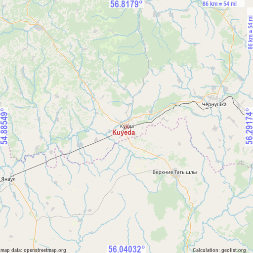
Kuyeda GPS coordinates[2]
56° 25' 51.96" North, 55° 35' 18.996" East
| Map corner | latitude | longitude |
|---|---|---|
| Upper-left | 56.8179°, | 54.88549° |
| Center: | 56.4311°, | 55.58861° |
| Lower-right: | 56.04032°, | 56.29174° |
| Map W x H: | 86.5×86.5 km | = 53.7×53.7mi |
| max Lat: | 73.50819° ⇑28% North |
| Kuyeda: | 56.4311° |
| min Lat: | ⇓72% South 41.28413° |
| min Long | Kuyeda | max Long |
| -179.12198° | 55.58861° | 179.35046° |
| W 67%⇐ | ⇒33% E |
Elevation
Elevation of Kuyeda is 130 m = 427 ft, and this is 72.6 m = 238 ft below average elevation for this country.
| Max E: |
2518 m = 8261 ft | 57.3% |
| Avg. | 202.6 m = 665 ft | |
| Kuyeda | 130 m = 427 ft | |
Min E: |
-28 m = -92 ft | 42.7% |
See also: Russia elevation on elevation.city.
Geographical zone
Kuyeda is located in North temperate zone (between Tropic of Cancer and the Arctic Circle). Distance of this North polar circle is 1126.6 km =700 mi to North.| Distance of | km | miles | from Kuyeda |
|---|---|---|---|
| North Pole | 3732.5 | 2319.3 | to North |
| Arctic Circle | 1126.6 | 700 | to North |
| Tropic Cancer | 3668.6 | 2279.6 | to South |
| Equator | 6274.6 | 3898.9 | to South |


Nearby cities:
15 places around Kuyeda: (largest is in red/bold)
• Amzya
77.3 km =48 mi,  253°
253°
• Askino
71.9 km =44.7 mi,  121°
121°
• Barda
55.3 km =34.4 mi,  0°
0°
• Burayevo
66.6 km =41.4 mi,  189°
189°
• Chernushka
31.1 km =19.3 mi,  74°
74°
• Foki
81.3 km =50.5 mi,  290°
290°
• Kaltasy
70.7 km =43.9 mi,  223°
223°
• Kambarka
87.2 km =54.2 mi,  257°
257°
• Krasnokholmskiy
59.7 km =37.1 mi,  214°
214°
• Neftekamsk
90 km =55.9 mi, 245°
• Starobaltachevo
52.2 km =32.4 mi,  156°
156°
• Uinskoye
78.7 km =48.9 mi,  50°
50°
• Verkhniye Tatyshly
22.7 km =14.1 mi,  133°
133°
• Yanaul
43.9 km =27.3 mi, 246°
• Yelovo
80.3 km =49.9 mi,  329°
329°
Sources, notices
• [Note1] Compared only with cities in Russia existing in our database
• [Src1] Map data: © OpenStreetMap contributors (CC-BY-SA)
• [Src2] Other city data from geonames.org with taken over terms of usage.
• [Src3] Geographical zone / Annual Mean Temperature by Robert A. Rohde @ Wikipedia
