Krasnokholmskiy geodata
Krasnokholmskiy (Bashkortostan Republic) is a populated place; located in Russia in Asia/Yekaterinburg (GMT+5) time zone. With population of 8,117 people, there are 1781 cities with bigger population in this country. Compared to other cities in Russia, 66.4% of cities are located further ↓South; 66.6% of cities are located further ←West and 68.4% of cities have higher elevation than Krasnokholmskiy. Note1


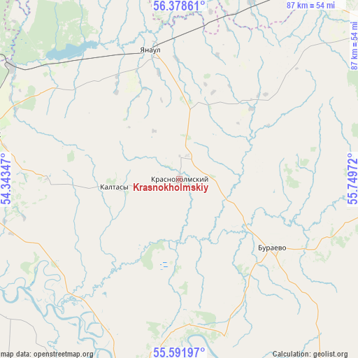
Krasnokholmskiy GPS coordinates[2]
55° 59' 14.244" North, 55° 2' 47.724" East
| Map corner | latitude | longitude |
|---|---|---|
| Upper-left | 56.37861°, | 54.34347° |
| Center: | 55.98729°, | 55.04659° |
| Lower-right: | 55.59197°, | 55.74972° |
| Map W x H: | 87.5×87.5 km | = 54.4×54.4mi |
| max Lat: | 73.50819° ⇑33.6% North |
| Krasnokholmskiy: | 55.98729° |
| min Lat: | ⇓66.4% South 41.28413° |
| min Long | Krasnokholmskiy | max Long |
| -179.12198° | 55.04659° | 179.35046° |
| W 66.6%⇐ | ⇒33.4% E |
Elevation
Elevation of Krasnokholmskiy is 106 m = 348 ft, and this is 96.6 m = 317 ft below average elevation for this country.
| Max E: |
2518 m = 8261 ft | 68.4% |
| Avg. | 202.6 m = 665 ft | |
| Krasnokholmskiy | 106 m = 348 ft | |
Min E: |
-28 m = -92 ft | 31.6% |
See also: Russia elevation on elevation.city.
Geographical zone
Krasnokholmskiy is located in North temperate zone (between Tropic of Cancer and the Arctic Circle). Distance of this North polar circle is 1176 km =730.7 mi to North.| Distance of | km | miles | from Krasnokholmskiy |
|---|---|---|---|
| North Pole | 3781.9 | 2350 | to North |
| Arctic Circle | 1176 | 730.7 | to North |
| Tropic Cancer | 3619.3 | 2248.9 | to South |
| Equator | 6225.2 | 3868.2 | to South |


Nearby cities:
15 places around Krasnokholmskiy: (largest is in red/bold)
• Agidel’
69.7 km =43.3 mi,  262°
262°
• Aktanysh
67 km =41.6 mi,  243°
243°
• Amzya
49.4 km =30.7 mi,  303°
303°
• Birsk
70.2 km =43.6 mi,  153°
153°
• Burayevo
27.8 km =17.3 mi,  125°
125°
• Dyurtyuli
56.3 km =35 mi,  191°
191°
• Kaltasy
15.3 km =9.5 mi, 262°
• Kama
68.8 km =42.8 mi, 300°
• Kambarka
60.7 km =37.7 mi, 300°
• Kuyeda
59.7 km =37.1 mi,  34°
34°
• Neftekamsk
49.9 km =31 mi,  283°
283°
• Nikolo-Berëzovka
57.4 km =35.7 mi,  285°
285°
• Starobaltachevo
54.8 km =34.1 mi,  88°
88°
• Verkhniye Tatyshly
60.5 km =37.6 mi,  56°
56°
• Yanaul
32.8 km =20.4 mi,  347°
347°
Sources, notices
• [Note1] Compared only with cities in Russia existing in our database
• [Src1] Map data: © OpenStreetMap contributors (CC-BY-SA)
• [Src2] Other city data from geonames.org with taken over terms of usage.
• [Src3] Geographical zone / Annual Mean Temperature by Robert A. Rohde @ Wikipedia
