Neftekamsk geodata
Neftekamsk (Bashkortostan Republic) is a populated place; located in Russia in Asia/Yekaterinburg (GMT+5) time zone. With population of 126,805 people, there are 162 cities with bigger population in this country. Compared to other cities in Russia, 67.8% of cities are located further ↓South; 65.9% of cities are located further ←West and 67.7% of cities have higher elevation than Neftekamsk. Note1


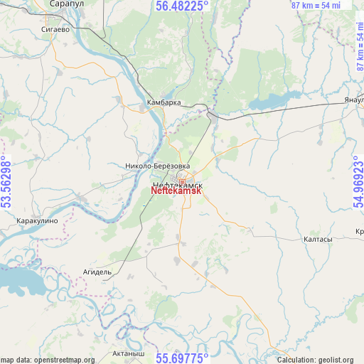
Neftekamsk GPS coordinates[2]
56° 5' 31.2" North, 54° 15' 57.96" East
| Map corner | latitude | longitude |
|---|---|---|
| Upper-left | 56.48225°, | 53.56298° |
| Center: | 56.092°, | 54.2661° |
| Lower-right: | 55.69775°, | 54.96923° |
| Map W x H: | 87.2×87.2 km | = 54.2×54.2mi |
| max Lat: | 73.50819° ⇑32.2% North |
| Neftekamsk: | 56.092° |
| min Lat: | ⇓67.8% South 41.28413° |
| min Long | Neftekamsk | max Long |
| -179.12198° | 54.2661° | 179.35046° |
| W 65.9%⇐ | ⇒34.1% E |
Elevation
Elevation of Neftekamsk is 108 m = 354 ft, and this is 94.6 m = 310 ft below average elevation for this country.
| Max E: |
2518 m = 8261 ft | 67.7% |
| Avg. | 202.6 m = 665 ft | |
| Neftekamsk | 108 m = 354 ft | |
Min E: |
-28 m = -92 ft | 32.3% |
See also: Neftekamsk elevation on elevation.city.
Geographical zone
Neftekamsk is located in North temperate zone (between Tropic of Cancer and the Arctic Circle). Distance of this North polar circle is 1164.3 km =723.5 mi to North.| Distance of | km | miles | from Neftekamsk |
|---|---|---|---|
| North Pole | 3770.2 | 2342.7 | to North |
| Arctic Circle | 1164.3 | 723.5 | to North |
| Tropic Cancer | 3630.9 | 2256.1 | to South |
| Equator | 6236.8 | 3875.4 | to South |


Nearby cities:
15 places around Neftekamsk: (largest is in red/bold)
• Agidel’
29 km =18 mi,  225°
225°
• Aktanysh
42.7 km =26.5 mi,  195°
195°
• Amzya
17.5 km =10.9 mi,  24°
24°
• Chaykovskiy
75.8 km =47.1 mi,  352°
352°
• Foki
67 km =41.6 mi,  4°
4°
• Kaltasy
36.1 km =22.4 mi,  112°
112°
• Kama
26 km =16.2 mi,  335°
335°
• Kambarka
19.8 km =12.3 mi, 349°
• Karakulino
35.9 km =22.3 mi,  255°
255°
• Krasnokholmskiy
49.9 km =31 mi,  103°
103°
• Nikolo-Berëzovka
7.7 km =4.8 mi,  297°
297°
• Sarapul
51.6 km =32.1 mi,  325°
325°
• Sigayevo
47.5 km =29.5 mi,  320°
320°
• Verkhneyarkeyevo
71.4 km =44.4 mi,  177°
177°
• Yanaul
46.1 km =28.6 mi,  63°
63°
Sources, notices
• [Note1] Compared only with cities in Russia existing in our database
• [Src1] Map data: © OpenStreetMap contributors (CC-BY-SA)
• [Src2] Other city data from geonames.org with taken over terms of usage.
• [Src3] Geographical zone / Annual Mean Temperature by Robert A. Rohde @ Wikipedia
