Starobaltachevo geodata
Starobaltachevo (Bashkortostan Republic) is a populated place; located in Russia in Asia/Yekaterinburg (GMT+5) time zone. With population of 5,612 people, there are 2396 cities with bigger population in this country. Compared to other cities in Russia, 66.6% of cities are located further ↓South; 67.4% of cities are located further ←West and 66% of cities have higher elevation than Starobaltachevo. Note1


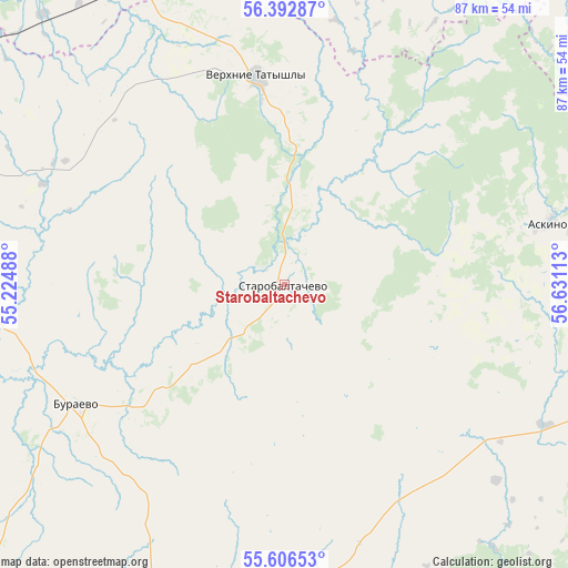
Starobaltachevo GPS coordinates[2]
56° 0' 6.12" North, 55° 55' 40.8" East
| Map corner | latitude | longitude |
|---|---|---|
| Upper-left | 56.39287°, | 55.22488° |
| Center: | 56.0017°, | 55.928° |
| Lower-right: | 55.60653°, | 56.63113° |
| Map W x H: | 87.4×87.4 km | = 54.3×54.3mi |
| max Lat: | 73.50819° ⇑33.4% North |
| Starobaltachevo: | 56.0017° |
| min Lat: | ⇓66.6% South 41.28413° |
| min Long | Starobaltachevo | max Long |
| -179.12198° | 55.928° | 179.35046° |
| W 67.4%⇐ | ⇒32.6% E |
Elevation
Elevation of Starobaltachevo is 111 m = 364 ft, and this is 91.6 m = 301 ft below average elevation for this country.
| Max E: |
2518 m = 8261 ft | 66% |
| Avg. | 202.6 m = 665 ft | |
| Starobaltachevo | 111 m = 364 ft | |
Min E: |
-28 m = -92 ft | 34% |
See also: Russia elevation on elevation.city.
Geographical zone
Starobaltachevo is located in North temperate zone (between Tropic of Cancer and the Arctic Circle). Distance of this North polar circle is 1174.4 km =729.7 mi to North.| Distance of | km | miles | from Starobaltachevo |
|---|---|---|---|
| North Pole | 3780.3 | 2349 | to North |
| Arctic Circle | 1174.4 | 729.7 | to North |
| Tropic Cancer | 3620.9 | 2249.9 | to South |
| Equator | 6226.8 | 3869.2 | to South |


Nearby cities:
15 places around Starobaltachevo: (largest is in red/bold)
• Askino
41.6 km =25.8 mi,  76°
76°
• Bedeyeva Polyana
80.8 km =50.2 mi,  159°
159°
• Birsk
68.9 km =42.8 mi,  200°
200°
• Burayevo
37 km =23 mi,  241°
241°
• Chernushka
57 km =35.4 mi,  9°
9°
• Kaltasy
70.1 km =43.6 mi,  267°
267°
• Karaidel’
63.8 km =39.6 mi,  107°
107°
• Karayar
76.2 km =47.3 mi,  116°
116°
• Krasnokholmskiy
54.8 km =34.1 mi, 268°
• Krasnyy Klyuch
82.1 km =51 mi,  146°
146°
• Kuyeda
52.2 km =32.4 mi,  336°
336°
• Maginsk
69.9 km =43.4 mi, 112°
• Pavlovka
75.6 km =47 mi, 148°
• Verkhniye Tatyshly
32.5 km =20.2 mi,  352°
352°
• Yanaul
68.7 km =42.7 mi,  296°
296°
Sources, notices
• [Note1] Compared only with cities in Russia existing in our database
• [Src1] Map data: © OpenStreetMap contributors (CC-BY-SA)
• [Src2] Other city data from geonames.org with taken over terms of usage.
• [Src3] Geographical zone / Annual Mean Temperature by Robert A. Rohde @ Wikipedia
