Konstantinovsk geodata
Konstantinovsk (Rostov) is a seat of a second-order administrative division; located in Russia in Europe/Moscow (GMT+3) time zone. With population of 18,876 people, there are 914 cities with bigger population in this country. Compared to other cities in Russia, 81.1% of cities are located further ↑North; 62.7% of cities are located further →East and 89.6% of cities have higher elevation than Konstantinovsk. Note1


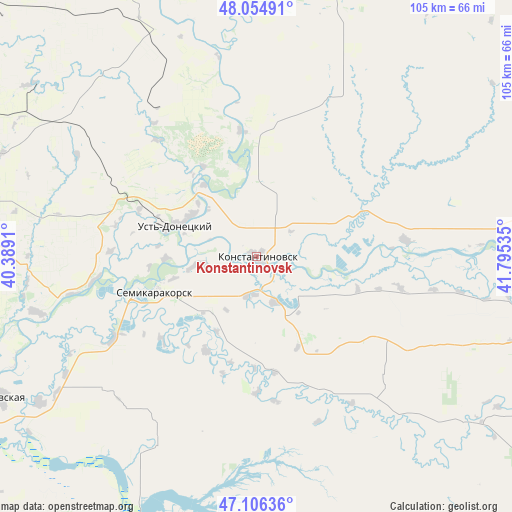
Konstantinovsk GPS coordinates[2]
47° 34' 58.008" North, 41° 5' 31.992" East
| Map corner | latitude | longitude |
|---|---|---|
| Upper-left | 48.05491°, | 40.3891° |
| Center: | 47.58278°, | 41.09222° |
| Lower-right: | 47.10636°, | 41.79535° |
| Map W x H: | 105.5×105.5 km | = 65.6×65.6mi |
| max Lat: | 73.50819° ⇑81.1% North |
| Konstantinovsk: | 47.58278° |
| min Lat: | ⇓18.9% South 41.28413° |
| min Long | Konstantinovsk | max Long |
| -179.12198° | 41.09222° | 179.35046° |
| W 37.3%⇐ | ⇒62.7% E |
Elevation
Elevation of Konstantinovsk is 30 m = 98 ft, and this is 172.6 m = 566 ft below average elevation for this country.
| Max E: |
2518 m = 8261 ft | 89.6% |
| Avg. | 202.6 m = 665 ft | |
| Konstantinovsk | 30 m = 98 ft | |
Min E: |
-28 m = -92 ft | 10.4% |
See also: Russia elevation on elevation.city.
Geographical zone
Konstantinovsk is located in North temperate zone (between Tropic of Cancer and the Arctic Circle). Distance of this North polar circle is 2110.5 km =1311.4 mi to North.| Distance of | km | miles | from Konstantinovsk |
|---|---|---|---|
| North Pole | 4716.4 | 2930.6 | to North |
| Arctic Circle | 2110.5 | 1311.4 | to North |
| Tropic Cancer | 2684.8 | 1668.3 | to South |
| Equator | 5290.7 | 3287.5 | to South |


Nearby cities:
15 places around Konstantinovsk: (largest is in red/bold)
• Bagayevskaya
60.3 km =37.5 mi,  241°
241°
• Bol’shaya Martynovka
55.2 km =34.3 mi,  128°
128°
• Bystrogorskiy
69.6 km =43.2 mi,  2°
2°
• Donskoy
65.5 km =40.7 mi,  253°
253°
• Kamenolomni
67.2 km =41.8 mi,  278°
278°
• Melikhovskaya
46.8 km =29.1 mi,  256°
256°
• Nikolayevskaya
30.9 km =19.2 mi,  83°
83°
• Novosvetlovsky
68.5 km =42.6 mi, 275°
• Semikarakorsk
22.7 km =14.1 mi, 251°
• Shakhty
67.2 km =41.8 mi, 282°
• Sinegorskiy
51.4 km =31.9 mi,  338°
338°
• Tatsinskiy
69.6 km =43.2 mi,  11°
11°
• Ust’-Donetskiy
17.8 km =11.1 mi,  291°
291°
• Vesëlyy
60.5 km =37.6 mi,  205°
205°
• Zhirnov
65.4 km =40.6 mi, 2°
Sources, notices
• [Note1] Compared only with cities in Russia existing in our database
• [Src1] Map data: © OpenStreetMap contributors (CC-BY-SA)
• [Src2] Other city data from geonames.org with taken over terms of usage.
• [Src3] Geographical zone / Annual Mean Temperature by Robert A. Rohde @ Wikipedia
