Nikolayevskaya geodata
Nikolayevskaya (Rostov) is a populated place; located in Russia in Europe/Moscow (GMT+3) time zone. With population of 3,613 people, there are 3327 cities with bigger population in this country. Compared to other cities in Russia, 81% of cities are located further ↑North; 61.4% of cities are located further →East and 94.5% of cities have higher elevation than Nikolayevskaya. Note1


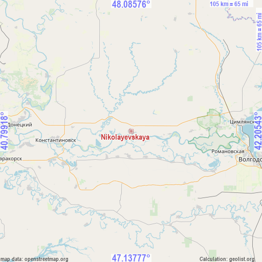
Nikolayevskaya GPS coordinates[2]
47° 36' 50.076" North, 41° 30' 8.28" East
| Map corner | latitude | longitude |
|---|---|---|
| Upper-left | 48.08576°, | 40.79918° |
| Center: | 47.61391°, | 41.5023° |
| Lower-right: | 47.13777°, | 42.20543° |
| Map W x H: | 105.4×105.4 km | = 65.5×65.5mi |
| max Lat: | 73.50819° ⇑81% North |
| Nikolayevskaya: | 47.61391° |
| min Lat: | ⇓19% South 41.28413° |
| min Long | Nikolayevskaya | max Long |
| -179.12198° | 41.5023° | 179.35046° |
| W 38.6%⇐ | ⇒61.4% E |
Elevation
Elevation of Nikolayevskaya is 14 m = 46 ft, and this is 188.6 m = 619 ft below average elevation for this country.
| Max E: |
2518 m = 8261 ft | 94.5% |
| Avg. | 202.6 m = 665 ft | |
| Nikolayevskaya | 14 m = 46 ft | |
Min E: |
-28 m = -92 ft | 5.5% |
See also: Russia elevation on elevation.city.
Geographical zone
Nikolayevskaya is located in North temperate zone (between Tropic of Cancer and the Arctic Circle). Distance of this North polar circle is 2107 km =1309.2 mi to North.| Distance of | km | miles | from Nikolayevskaya |
|---|---|---|---|
| North Pole | 4712.9 | 2928.5 | to North |
| Arctic Circle | 2107 | 1309.2 | to North |
| Tropic Cancer | 2688.3 | 1670.4 | to South |
| Equator | 5294.2 | 3289.7 | to South |


Nearby cities:
15 places around Nikolayevskaya: (largest is in red/bold)
• Bol’shaya Martynovka
39.7 km =24.7 mi,  161°
161°
• Bystrogorskiy
71.3 km =44.3 mi,  337°
337°
• Konstantinovsk
30.9 km =19.2 mi,  263°
263°
• Krasnoyarskaya
40.8 km =25.4 mi,  84°
84°
• Krasnoyarskaya
52.9 km =32.9 mi,  104°
104°
• Melikhovskaya
77.6 km =48.2 mi, 259°
• Romanovskaya
40.3 km =25 mi, 101°
• Semikarakorsk
53.4 km =33.2 mi, 258°
• Sinegorskiy
66.2 km =41.1 mi,  312°
312°
• Tatsinskiy
67 km =41.6 mi,  345°
345°
• Tsimlyansk
45.1 km =28 mi,  85°
85°
• Uglegorskiy
72.3 km =44.9 mi, 345°
• Ust’-Donetskiy
47.3 km =29.4 mi,  273°
273°
• Volgodonsk
50 km =31.1 mi, 102°
• Zhirnov
68 km =42.3 mi, 335°
Sources, notices
• [Note1] Compared only with cities in Russia existing in our database
• [Src1] Map data: © OpenStreetMap contributors (CC-BY-SA)
• [Src2] Other city data from geonames.org with taken over terms of usage.
• [Src3] Geographical zone / Annual Mean Temperature by Robert A. Rohde @ Wikipedia
