Kondopoga geodata
Kondopoga (Karelia) is a populated place; located in Russia in Europe/Moscow (GMT+3) time zone. With population of 34,360 people, there are 586 cities with bigger population in this country. Compared to other cities in Russia, 95.2% of cities are located further ↓South; 90.2% of cities are located further →East and 81.1% of cities have higher elevation than Kondopoga. Note1


Kondopoga GPS coordinates[2]
62° 12' 20.34" North, 34° 15' 40.968" East
| Map corner | latitude | longitude |
|---|---|---|
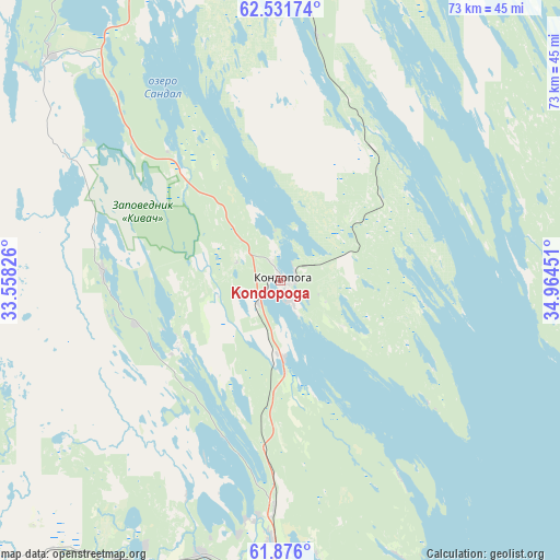
| Upper-left | 62.53174°, | 33.55826° |
| Center: | 62.20565°, | 34.26138° |
| Lower-right: | 61.876°, | 34.96451° |
| Map W x H: | 72.9×72.9 km | = 45.3×45.3mi |
| max Lat: | 73.50819° ⇑4.8% North |
| Kondopoga: | 62.20565° |
| min Lat: | ⇓95.2% South 41.28413° |
| min Long | Kondopoga | max Long |
| -179.12198° | 34.26138° | 179.35046° |
| W 9.8%⇐ | ⇒90.2% E |
Elevation
Elevation of Kondopoga is 67 m = 220 ft, and this is 135.6 m = 445 ft below average elevation for this country.
| Max E: |
2518 m = 8261 ft | 81.1% |
| Avg. | 202.6 m = 665 ft | |
| Kondopoga | 67 m = 220 ft | |
Min E: |
-28 m = -92 ft | 18.9% |
See also: Russia elevation on elevation.city.
Geographical zone
Kondopoga is located in North temperate zone (between Tropic of Cancer and the Arctic Circle). Distance of this North polar circle is 484.6 km =301.1 mi to North.| Distance of | km | miles | from Kondopoga |
|---|---|---|---|
| North Pole | 3090.4 | 1920.3 | to North |
| Arctic Circle | 484.6 | 301.1 | to North |
| Tropic Cancer | 4310.7 | 2678.5 | to South |
| Equator | 6916.6 | 4297.8 | to South |


Nearby cities:
15 places around Kondopoga: (largest is in red/bold)
• Essoyla
69 km =42.9 mi,  237°
237°
• Girvas
42.6 km =26.5 mi,  315°
315°
• Kvartsitnyy
88.9 km =55.2 mi,  153°
153°
• Matrosy
52.8 km =32.8 mi,  206°
206°
• Medvezh’yegorsk
79.7 km =49.5 mi,  7°
7°
• Petrozavodsk
47 km =29.2 mi,  174°
174°
• Pindushi
80.6 km =50.1 mi, 11°
• Porosozero
97.4 km =60.5 mi,  305°
305°
• Povenets
77.1 km =47.9 mi,  22°
22°
• Pryazha
66.1 km =41.1 mi, 210°
• Shun’ga
56.5 km =35.1 mi,  38°
38°
• Shuya
28.2 km =17.5 mi,  183°
183°
• Syapsya
55.4 km =34.4 mi, 235°
• Veshkelitsa
81.9 km =50.9 mi,  247°
247°
• Yanishpole
10.5 km =6.5 mi, 177°
Sources, notices
• [Note1] Compared only with cities in Russia existing in our database
• [Src1] Map data: © OpenStreetMap contributors (CC-BY-SA)
• [Src2] Other city data from geonames.org with taken over terms of usage.
• [Src3] Geographical zone / Annual Mean Temperature by Robert A. Rohde @ Wikipedia
