Staropavlovskaya geodata
Staropavlovskaya (Stavropol’ Kray) is a populated place; located in Russia in Europe/Moscow (GMT+3) time zone. With population of 3,081 people, there are 3709 cities with bigger population in this country. Compared to other cities in Russia, 92.5% of cities are located further ↑North; 54.2% of cities are located further →East and 85.3% of cities have lower elevation than Staropavlovskaya. Note1


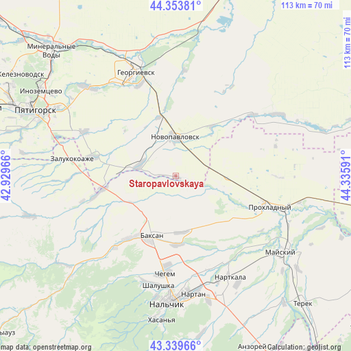
Staropavlovskaya GPS coordinates[2]
43° 50' 56.004" North, 43° 37' 58.008" East
| Map corner | latitude | longitude |
|---|---|---|
| Upper-left | 44.35381°, | 42.92966° |
| Center: | 43.84889°, | 43.63278° |
| Lower-right: | 43.33966°, | 44.33591° |
| Map W x H: | 112.8×112.8 km | = 70.1×70.1mi |
| max Lat: | 73.50819° ⇑92.5% North |
| Staropavlovskaya: | 43.84889° |
| min Lat: | ⇓7.5% South 41.28413° |
| min Long | Staropavlovskay | max Long |
| -179.12198° | 43.63278° | 179.35046° |
| W 45.8%⇐ | ⇒54.2% E |
Elevation
Elevation of Staropavlovskaya is 328 m = 1076 ft, and this is 125.4 m = 411 ft above average elevation for this country.
| Max E: |
2518 m = 8261 ft | 14.7% |
| Staropavlovskaya | 328 m 1076 ft | |
| Avg. | 202.6 m = 665 ft | |
Min E: |
-28 m = -92 ft | 85.3% |
See also: Russia elevation on elevation.city.
Geographical zone
Staropavlovskaya is located in North temperate zone (between Tropic of Cancer and the Arctic Circle). Distance of this Northern Tropic circle is 2269.6 km =1410.3 mi to South.| Distance of | km | miles | from Staropavlovskaya |
|---|---|---|---|
| North Pole | 5131.5 | 3188.6 | to North |
| Arctic Circle | 2525.6 | 1569.3 | to North |
| Tropic Cancer | 2269.6 | 1410.3 | to South |
| Equator | 4875.5 | 3029.5 | to South |


Nearby cities:
15 places around Staropavlovskaya: (largest is in red/bold)
• Altud
23.4 km =14.5 mi,  127°
127°
• Baksan
19.5 km =12.1 mi,  203°
203°
• Baksanenok
17.8 km =11.1 mi,  174°
174°
• Chegem Vtoroy
28.3 km =17.6 mi,  185°
185°
• Dugulubgey
22.1 km =13.7 mi, 200°
• Islamey
24 km =14.9 mi,  216°
216°
• Karagach
12.4 km =7.7 mi,  113°
113°
• Kishpek
21.6 km =13.4 mi,  178°
178°
• Komsomolets
19.7 km =12.2 mi,  345°
345°
• Kuba-Taba
17.3 km =10.7 mi,  242°
242°
• Kyzburun Pervyy
29.1 km =18.1 mi, 221°
• Malka
25.3 km =15.7 mi,  258°
258°
• Nizhniy Kurkuzhin
25.3 km =15.7 mi, 243°
• Novopavlovsk
12.6 km =7.8 mi,  0°
0°
• Soldatskaya
15.1 km =9.4 mi,  103°
103°
Sources, notices
• [Note1] Compared only with cities in Russia existing in our database
• [Src1] Map data: © OpenStreetMap contributors (CC-BY-SA)
• [Src2] Other city data from geonames.org with taken over terms of usage.
• [Src3] Geographical zone / Annual Mean Temperature by Robert A. Rohde @ Wikipedia
