Karagach geodata
Karagach (Kabardino-Balkariya Republic) is a populated place; located in Russia in Europe/Moscow (GMT+3) time zone. With population of 5,870 people, there are 2307 cities with bigger population in this country. Compared to other cities in Russia, 92.6% of cities are located further ↑North; 53.6% of cities are located further →East and 81.6% of cities have lower elevation than Karagach. Note1


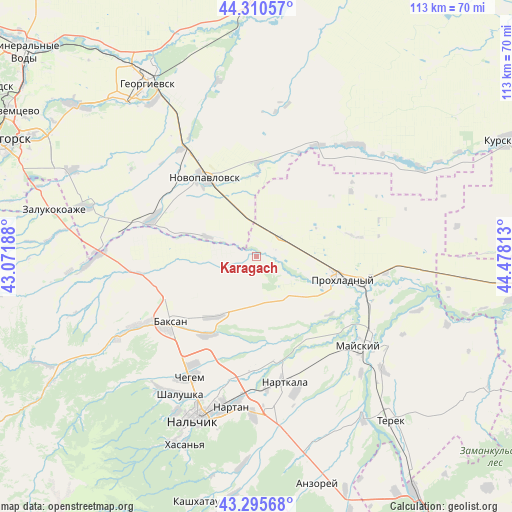
Karagach GPS coordinates[2]
43° 48' 19.008" North, 43° 46' 30" East
| Map corner | latitude | longitude |
|---|---|---|
| Upper-left | 44.31057°, | 43.07188° |
| Center: | 43.80528°, | 43.775° |
| Lower-right: | 43.29568°, | 44.47813° |
| Map W x H: | 112.8×112.8 km | = 70.1×70.1mi |
| max Lat: | 73.50819° ⇑92.6% North |
| Karagach: | 43.80528° |
| min Lat: | ⇓7.4% South 41.28413° |
| min Long | Karagach | max Long |
| -179.12198° | 43.775° | 179.35046° |
| W 46.4%⇐ | ⇒53.6% E |
Elevation
Elevation of Karagach is 269 m = 883 ft, and this is 66.4 m = 218 ft above average elevation for this country.
| Max E: |
2518 m = 8261 ft | 18.4% |
| Karagach | 269 m 883 ft | |
| Avg. | 202.6 m = 665 ft | |
Min E: |
-28 m = -92 ft | 81.6% |
See also: Russia elevation on elevation.city.
Geographical zone
Karagach is located in North temperate zone (between Tropic of Cancer and the Arctic Circle). Distance of this Northern Tropic circle is 2264.8 km =1407.3 mi to South.| Distance of | km | miles | from Karagach |
|---|---|---|---|
| North Pole | 5136.4 | 3191.6 | to North |
| Arctic Circle | 2530.5 | 1572.4 | to North |
| Tropic Cancer | 2264.8 | 1407.3 | to South |
| Equator | 4870.7 | 3026.5 | to South |


Nearby cities:
15 places around Karagach: (largest is in red/bold)
• Altud
11.8 km =7.3 mi,  141°
141°
• Baksan
23.1 km =14.4 mi,  235°
235°
• Baksanenok
16.1 km =10 mi,  216°
216°
• Chegem Vtoroy
27.2 km =16.9 mi,  211°
211°
• Dugulubgey
24.9 km =15.5 mi,  230°
230°
• Germenchik
23.5 km =14.6 mi,  181°
181°
• Kishpek
19.9 km =12.4 mi, 212°
• Kuba-Taba
26.9 km =16.7 mi,  263°
263°
• Mayskiy
27.9 km =17.3 mi,  130°
130°
• Nartkala
28.2 km =17.5 mi,  167°
167°
• Novopavlovsk
20.8 km =12.9 mi,  327°
327°
• Primalkinskoye
19.8 km =12.3 mi,  109°
109°
• Prokhladnyy
21.1 km =13.1 mi,  104°
104°
• Soldatskaya
3.6 km =2.2 mi,  66°
66°
• Staropavlovskaya
12.4 km =7.7 mi,  293°
293°
Sources, notices
• [Note1] Compared only with cities in Russia existing in our database
• [Src1] Map data: © OpenStreetMap contributors (CC-BY-SA)
• [Src2] Other city data from geonames.org with taken over terms of usage.
• [Src3] Geographical zone / Annual Mean Temperature by Robert A. Rohde @ Wikipedia
