Kavkazskiy geodata
Kavkazskiy (Karachayevo-Cherkesiya Republic) is a populated place; located in Russia in Europe/Moscow (GMT+3) time zone. With population of 3,052 people, there are 3740 cities with bigger population in this country. Compared to other cities in Russia, 90.3% of cities are located further ↑North; 58.9% of cities are located further →East and 95.5% of cities have lower elevation than Kavkazskiy. Note1


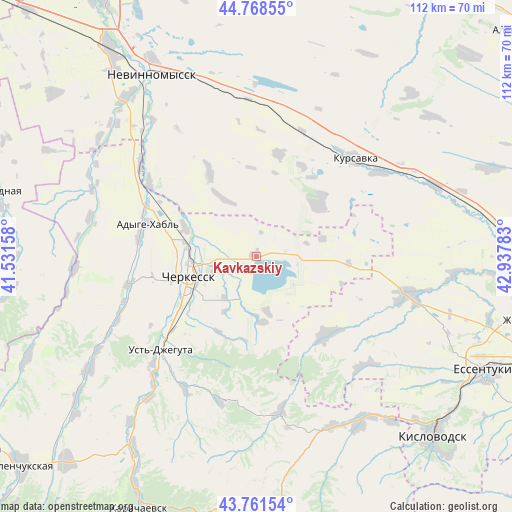
Kavkazskiy GPS coordinates[2]
44° 16' 1.92" North, 42° 14' 4.92" East
| Map corner | latitude | longitude |
|---|---|---|
| Upper-left | 44.76855°, | 41.53158° |
| Center: | 44.2672°, | 42.2347° |
| Lower-right: | 43.76154°, | 42.93783° |
| Map W x H: | 112×112 km | = 69.6×69.6mi |
| max Lat: | 73.50819° ⇑90.3% North |
| Kavkazskiy: | 44.2672° |
| min Lat: | ⇓9.7% South 41.28413° |
| min Long | Kavkazskiy | max Long |
| -179.12198° | 42.2347° | 179.35046° |
| W 41.1%⇐ | ⇒58.9% E |
Elevation
Elevation of Kavkazskiy is 670 m = 2198 ft, and this is 467.4 m = 1533 ft above average elevation for this country.
| Max E: |
2518 m = 8261 ft | 4.5% |
| Kavkazskiy | 670 m 2198 ft | |
| Avg. | 202.6 m = 665 ft | |
Min E: |
-28 m = -92 ft | 95.5% |
See also: Russia elevation on elevation.city.
Geographical zone
Kavkazskiy is located in North temperate zone (between Tropic of Cancer and the Arctic Circle). Distance of this Northern Tropic circle is 2316.1 km =1439.2 mi to South.| Distance of | km | miles | from Kavkazskiy |
|---|---|---|---|
| North Pole | 5085 | 3159.7 | to North |
| Arctic Circle | 2479.1 | 1540.4 | to North |
| Tropic Cancer | 2316.1 | 1439.2 | to South |
| Equator | 4922.1 | 3058.5 | to South |


Nearby cities:
15 places around Kavkazskiy: (largest is in red/bold)
• Adyge-Khabl’
24.7 km =15.3 mi,  287°
287°
• Bekeshevskaya
22.9 km =14.2 mi,  138°
138°
• Besleney
39.6 km =24.6 mi,  265°
265°
• Borgustanskaya
33.3 km =20.7 mi, 135°
• Cherkessk
14.9 km =9.3 mi,  250°
250°
• Druzhba
19.1 km =11.9 mi, 245°
• Ikon-Khalk
25.9 km =16.1 mi,  279°
279°
• Kursavka
30.3 km =18.8 mi,  46°
46°
• Pervomayskoye
41.3 km =25.7 mi,  152°
152°
• Psyzh
17.6 km =10.9 mi,  257°
257°
• Soluno-Dmitriyevskoye
41.9 km =26 mi,  68°
68°
• Suvorovskaya
34.9 km =21.7 mi,  104°
104°
• Tereze
40.4 km =25.1 mi,  155°
155°
• Udarnyy
23.4 km =14.5 mi, 67°
• Ust’-Dzheguta
29 km =18 mi,  225°
225°
Sources, notices
• [Note1] Compared only with cities in Russia existing in our database
• [Src1] Map data: © OpenStreetMap contributors (CC-BY-SA)
• [Src2] Other city data from geonames.org with taken over terms of usage.
• [Src3] Geographical zone / Annual Mean Temperature by Robert A. Rohde @ Wikipedia
