Golovchino geodata
Golovchino (Belgorod Oblast) is a populated place; located in Russia in Europe/Moscow (GMT+3) time zone. With population of 5,356 people, there are 2487 cities with bigger population in this country. Compared to other cities in Russia, 76.5% of cities are located further ↑North; 87.8% of cities are located further →East and 52.1% of cities have higher elevation than Golovchino. Note1


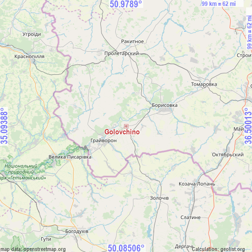
Golovchino GPS coordinates[2]
50° 32' 2.76" North, 35° 47' 49.2" East
| Map corner | latitude | longitude |
|---|---|---|
| Upper-left | 50.9789°, | 35.09388° |
| Center: | 50.5341°, | 35.797° |
| Lower-right: | 50.08506°, | 36.50013° |
| Map W x H: | 99.4×99.4 km | = 61.8×61.8mi |
| max Lat: | 73.50819° ⇑76.5% North |
| Golovchino: | 50.5341° |
| min Lat: | ⇓23.5% South 41.28413° |
| min Long | Golovchino | max Long |
| -179.12198° | 35.797° | 179.35046° |
| W 12.2%⇐ | ⇒87.8% E |
Elevation
Elevation of Golovchino is 140 m = 459 ft, and this is 62.6 m = 205 ft below average elevation for this country.
| Max E: |
2518 m = 8261 ft | 52.1% |
| Avg. | 202.6 m = 665 ft | |
| Golovchino | 140 m = 459 ft | |
Min E: |
-28 m = -92 ft | 47.9% |
See also: Russia elevation on elevation.city.
Geographical zone
Golovchino is located in North temperate zone (between Tropic of Cancer and the Arctic Circle). Distance of this North polar circle is 1782.3 km =1107.5 mi to North.| Distance of | km | miles | from Golovchino |
|---|---|---|---|
| North Pole | 4388.2 | 2726.7 | to North |
| Arctic Circle | 1782.3 | 1107.5 | to North |
| Tropic Cancer | 3012.9 | 1872.1 | to South |
| Equator | 5618.9 | 3491.4 | to South |


Nearby cities:
15 places around Golovchino: (largest is in red/bold)
• Belaya
58.1 km =36.1 mi,  354°
354°
• Belgorod
56 km =34.8 mi,  81°
81°
• Bessonovka
35.6 km =22.1 mi,  91°
91°
• Borisovka
17.2 km =10.7 mi,  64°
64°
• Grayvoron
10.6 km =6.6 mi,  232°
232°
• Ivnya
63.4 km =39.4 mi,  21°
21°
• Krasnaya Yaruga
31.2 km =19.4 mi,  341°
341°
• Mayskiy
46.8 km =29.1 mi, 91°
• Proletarskiy
28.7 km =17.8 mi,  356°
356°
• Rakitnoye
34.1 km =21.2 mi,  6°
6°
• Razumnoye
62.7 km =39 mi, 89°
• Severnyy
55.7 km =34.6 mi,  73°
73°
• Stroitel’
55.9 km =34.7 mi, 59°
• Tomarovka
35 km =21.7 mi, 61°
• Yakovlevo
58.5 km =36.4 mi,  51°
51°
Sources, notices
• [Note1] Compared only with cities in Russia existing in our database
• [Src1] Map data: © OpenStreetMap contributors (CC-BY-SA)
• [Src2] Other city data from geonames.org with taken over terms of usage.
• [Src3] Geographical zone / Annual Mean Temperature by Robert A. Rohde @ Wikipedia
