Dyurtyuli geodata
Dyurtyuli (Bashkortostan Republic) is a populated place; located in Russia in Asia/Yekaterinburg (GMT+5) time zone. With population of 31,087 people, there are 632 cities with bigger population in this country. Compared to other cities in Russia, 58% of cities are located further ↓South; 66.4% of cities are located further ←West and 75.5% of cities have higher elevation than Dyurtyuli. Note1


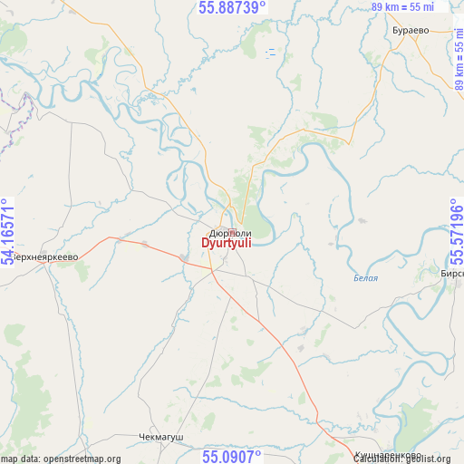
Dyurtyuli GPS coordinates[2]
55° 29' 27.816" North, 54° 52' 7.788" East
| Map corner | latitude | longitude |
|---|---|---|
| Upper-left | 55.88739°, | 54.16571° |
| Center: | 55.49106°, | 54.86883° |
| Lower-right: | 55.0907°, | 55.57196° |
| Map W x H: | 88.6×88.6 km | = 55.1×55.1mi |
| max Lat: | 73.50819° ⇑42% North |
| Dyurtyuli: | 55.49106° |
| min Lat: | ⇓58% South 41.28413° |
| min Long | Dyurtyuli | max Long |
| -179.12198° | 54.86883° | 179.35046° |
| W 66.4%⇐ | ⇒33.6% E |
Elevation
Elevation of Dyurtyuli is 86 m = 282 ft, and this is 116.6 m = 383 ft below average elevation for this country.
| Max E: |
2518 m = 8261 ft | 75.5% |
| Avg. | 202.6 m = 665 ft | |
| Dyurtyuli | 86 m = 282 ft | |
Min E: |
-28 m = -92 ft | 24.5% |
See also: Russia elevation on elevation.city.
Geographical zone
Dyurtyuli is located in North temperate zone (between Tropic of Cancer and the Arctic Circle). Distance of this North polar circle is 1231.1 km =765 mi to North.| Distance of | km | miles | from Dyurtyuli |
|---|---|---|---|
| North Pole | 3837 | 2384.2 | to North |
| Arctic Circle | 1231.1 | 765 | to North |
| Tropic Cancer | 3564.1 | 2214.6 | to South |
| Equator | 6170 | 3833.9 | to South |


Nearby cities:
15 places around Dyurtyuli: (largest is in red/bold)
• Agidel’
74.6 km =46.4 mi,  308°
308°
• Aktanysh
55.6 km =34.5 mi,  297°
297°
• Alekseyevka
74.9 km =46.5 mi,  162°
162°
• Asanovo
77.2 km =48 mi,  149°
149°
• Bakaly
75.8 km =47.1 mi,  242°
242°
• Birsk
43.2 km =26.8 mi,  100°
100°
• Burayevo
51.5 km =32 mi,  41°
41°
• Chekmagush
42.1 km =26.2 mi,  198°
198°
• Kaltasy
53.3 km =33.1 mi,  355°
355°
• Krasnokholmskiy
56.3 km =35 mi,  11°
11°
• Kushnarënkovo
52.7 km =32.7 mi,  144°
144°
• Neftekamsk
76.7 km =47.7 mi,  330°
330°
• Nikolo-Berëzovka
83.3 km =51.8 mi, 327°
• Semiletka
21.6 km =13.4 mi,  227°
227°
• Verkhneyarkeyevo
35.2 km =21.9 mi,  262°
262°
Sources, notices
• [Note1] Compared only with cities in Russia existing in our database
• [Src1] Map data: © OpenStreetMap contributors (CC-BY-SA)
• [Src2] Other city data from geonames.org with taken over terms of usage.
• [Src3] Geographical zone / Annual Mean Temperature by Robert A. Rohde @ Wikipedia
