Zverinogolovskoye geodata
Zverinogolovskoye (Kurgan Oblast) is a populated place; located in Russia in Asia/Yekaterinburg (GMT+5) time zone. With population of 4,400 people, there are 2909 cities with bigger population in this country. Compared to other cities in Russia, 51.4% of cities are located further ↑North; 75.7% of cities are located further ←West and 71.9% of cities have higher elevation than Zverinogolovskoye. Note1


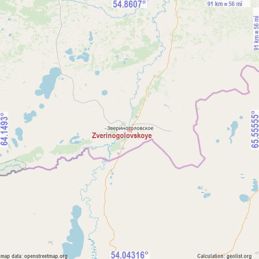
Zverinogolovskoye GPS coordinates[2]
54° 27' 14.292" North, 64° 51' 8.712" East
| Map corner | latitude | longitude |
|---|---|---|
| Upper-left | 54.8607°, | 64.1493° |
| Center: | 54.45397°, | 64.85242° |
| Lower-right: | 54.04316°, | 65.55555° |
| Map W x H: | 90.9×90.9 km | = 56.5×56.5mi |
| max Lat: | 73.50819° ⇑51.4% North |
| Zverinogolovskoye: | 54.45397° |
| min Lat: | ⇓48.6% South 41.28413° |
| min Long | Zverinogolovsko | max Long |
| -179.12198° | 64.85242° | 179.35046° |
| W 75.7%⇐ | ⇒24.3% E |
Elevation
Elevation of Zverinogolovskoye is 98 m = 322 ft, and this is 104.6 m = 343 ft below average elevation for this country.
| Max E: |
2518 m = 8261 ft | 71.9% |
| Avg. | 202.6 m = 665 ft | |
| Zverinogolovskoye | 98 m = 322 ft | |
Min E: |
-28 m = -92 ft | 28.1% |
See also: Russia elevation on elevation.city.
Geographical zone
Zverinogolovskoye is located in North temperate zone (between Tropic of Cancer and the Arctic Circle). Distance of this North polar circle is 1346.5 km =836.7 mi to North.| Distance of | km | miles | from Zverinogolovskoye |
|---|---|---|---|
| North Pole | 3952.3 | 2455.8 | to North |
| Arctic Circle | 1346.5 | 836.7 | to North |
| Tropic Cancer | 3448.8 | 2143 | to South |
| Equator | 6054.7 | 3762.2 | to South |


Nearby cities:
15 places around Zverinogolovskoye: (largest is in red/bold)
• Glyadyanskoye
52.7 km =32.7 mi,  16°
16°
• Ikovka
128.5 km =79.8 mi,  2°
2°
• Ketovo
104.7 km =65.1 mi, 16°
• Krasnyy Oktyabr’
133.8 km =83.1 mi,  358°
358°
• Kurgan
114.9 km =71.4 mi, 15°
• Kurtamysh
57.5 km =35.7 mi,  331°
331°
• Lesnikovo
96.8 km =60.1 mi, 17°
• Mishkino
115.1 km =71.5 mi, 328°
• Polovinnoye
82.1 km =51 mi,  62°
62°
• Prosvet
125 km =77.7 mi,  6°
6°
• Shumikha
131.5 km =81.7 mi,  310°
310°
• Tselinnoye
76.3 km =47.4 mi,  273°
273°
• Vargashi
118.7 km =73.8 mi,  32°
32°
• Vvedenskoye
114.4 km =71.1 mi, 7°
• Yurgamysh
105.4 km =65.5 mi,  346°
346°
Sources, notices
• [Note1] Compared only with cities in Russia existing in our database
• [Src1] Map data: © OpenStreetMap contributors (CC-BY-SA)
• [Src2] Other city data from geonames.org with taken over terms of usage.
• [Src3] Geographical zone / Annual Mean Temperature by Robert A. Rohde @ Wikipedia
