Tselinnoye geodata
Tselinnoye (Kurgan Oblast) is a populated place; located in Russia in Asia/Yekaterinburg (GMT+5) time zone. With population of 5,711 people, there are 2359 cities with bigger population in this country. Compared to other cities in Russia, 51% of cities are located further ↑North; 75.1% of cities are located further ←West and 52.6% of cities have higher elevation than Tselinnoye. Note1


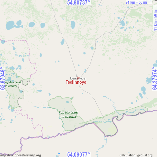
Tselinnoye GPS coordinates[2]
54° 30' 3.996" North, 63° 40' 24.996" East
| Map corner | latitude | longitude |
|---|---|---|
| Upper-left | 54.90737°, | 62.97049° |
| Center: | 54.50111°, | 63.67361° |
| Lower-right: | 54.09077°, | 64.37674° |
| Map W x H: | 90.8×90.8 km | = 56.4×56.4mi |
| max Lat: | 73.50819° ⇑51% North |
| Tselinnoye: | 54.50111° |
| min Lat: | ⇓49% South 41.28413° |
| min Long | Tselinnoye | max Long |
| -179.12198° | 63.67361° | 179.35046° |
| W 75.1%⇐ | ⇒24.9% E |
Elevation
Elevation of Tselinnoye is 139 m = 456 ft, and this is 63.6 m = 209 ft below average elevation for this country.
| Max E: |
2518 m = 8261 ft | 52.6% |
| Avg. | 202.6 m = 665 ft | |
| Tselinnoye | 139 m = 456 ft | |
Min E: |
-28 m = -92 ft | 47.4% |
See also: Russia elevation on elevation.city.
Geographical zone
Tselinnoye is located in North temperate zone (between Tropic of Cancer and the Arctic Circle). Distance of this North polar circle is 1341.2 km =833.4 mi to North.| Distance of | km | miles | from Tselinnoye |
|---|---|---|---|
| North Pole | 3947.1 | 2452.6 | to North |
| Arctic Circle | 1341.2 | 833.4 | to North |
| Tropic Cancer | 3454 | 2146.2 | to South |
| Equator | 6060 | 3765.5 | to South |


Nearby cities:
15 places around Tselinnoye: (largest is in red/bold)
• Bobrovka
135 km =83.9 mi,  248°
248°
• Glyadyanskoye
101.5 km =63.1 mi,  63°
63°
• Kanashevo
130.2 km =80.9 mi,  307°
307°
• Ketovo
142 km =88.2 mi,  48°
48°
• Kurtamysh
66.7 km =41.4 mi, 46°
• Lesnikovo
136.4 km =84.8 mi, 50°
• Miasskoye
143.1 km =88.9 mi, 307°
• Mishkino
94.4 km =58.7 mi,  9°
9°
• Safakulevo
90.6 km =56.3 mi, 306°
• Selezyan
127 km =78.9 mi,  290°
290°
• Shumikha
84.2 km =52.3 mi,  343°
343°
• Vvedenskoye
140.7 km =87.4 mi,  39°
39°
• Yetkul’
138.8 km =86.2 mi,  284°
284°
• Yurgamysh
109.4 km =68 mi,  27°
27°
• Zverinogolovskoye
76.3 km =47.4 mi,  93°
93°
Sources, notices
• [Note1] Compared only with cities in Russia existing in our database
• [Src1] Map data: © OpenStreetMap contributors (CC-BY-SA)
• [Src2] Other city data from geonames.org with taken over terms of usage.
• [Src3] Geographical zone / Annual Mean Temperature by Robert A. Rohde @ Wikipedia
