Tisul’ geodata
Tisul’ (Kemerovo Oblast) is a populated place; located in Russia in Asia/Novokuznetsk (GMT+7) time zone. With population of 9,249 people, there are 1620 cities with bigger population in this country. Compared to other cities in Russia, 63% of cities are located further ↓South; 85.2% of cities are located further ←West and 70.8% of cities have lower elevation than Tisul’. Note1


Tisul’ GPS coordinates[2]
55° 45' 42.228" North, 88° 18' 44.208" East
| Map corner | latitude | longitude |
|---|---|---|
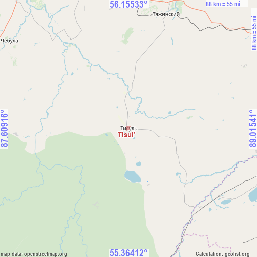
| Upper-left | 56.15533°, | 87.60916° |
| Center: | 55.76173°, | 88.31228° |
| Lower-right: | 55.36412°, | 89.01541° |
| Map W x H: | 88×88 km | = 54.7×54.7mi |
| max Lat: | 73.50819° ⇑37% North |
| Tisul’: | 55.76173° |
| min Lat: | ⇓63% South 41.28413° |
| min Long | Tisul’ | max Long |
| -179.12198° | 88.31228° | 179.35046° |
| W 85.2%⇐ | ⇒14.8% E |
Elevation
Elevation of Tisul’ is 200 m = 656 ft, and this is 2.6 m = 9 ft below average elevation for this country.
| Max E: |
2518 m = 8261 ft | 29.2% |
| Avg. | 202.6 m = 665 ft | |
| Tisul’ | 200 m = 656 ft | |
Min E: |
-28 m = -92 ft | 70.8% |
See also: Russia elevation on elevation.city.
Geographical zone
Tisul’ is located in North temperate zone (between Tropic of Cancer and the Arctic Circle). Distance of this North polar circle is 1201.1 km =746.3 mi to North.| Distance of | km | miles | from Tisul’ |
|---|---|---|---|
| North Pole | 3806.9 | 2365.5 | to North |
| Arctic Circle | 1201.1 | 746.3 | to North |
| Tropic Cancer | 3594.2 | 2233.3 | to South |
| Equator | 6200.1 | 3852.6 | to South |


Nearby cities:
15 places around Tisul’: (largest is in red/bold)
• Barzas
124.6 km =77.4 mi,  268°
268°
• Belogorsk
83.5 km =51.9 mi,  172°
172°
• Bogotol
90.8 km =56.4 mi,  56°
56°
• Dubinino
51.3 km =31.9 mi,  107°
107°
• Goryachegorsk
55.1 km =34.2 mi,  136°
136°
• Itatskiy
56.7 km =35.2 mi,  52°
52°
• Izhmorskiy
114.4 km =71.1 mi,  294°
294°
• Mariinsk
61.3 km =38.1 mi,  325°
325°
• Sharypovo
60.9 km =37.8 mi, 113°
• Suslovo
52 km =32.3 mi,  346°
346°
• Tyazhinskiy
41.5 km =25.8 mi,  18°
18°
• Tyukhtet
106.4 km =66.1 mi,  35°
35°
• Uzhur
107.9 km =67 mi,  117°
117°
• Verkh-Chebula
52.4 km =32.6 mi,  304°
304°
• Zelenogorskiy
115.9 km =72 mi,  225°
225°
Sources, notices
• [Note1] Compared only with cities in Russia existing in our database
• [Src1] Map data: © OpenStreetMap contributors (CC-BY-SA)
• [Src2] Other city data from geonames.org with taken over terms of usage.
• [Src3] Geographical zone / Annual Mean Temperature by Robert A. Rohde @ Wikipedia
