Uznezya geodata
Uznezya (Altai) is a populated place; located in Russia in Asia/Barnaul (GMT+7) time zone. With population of 501 people, there are 4964 cities with bigger population in this country. Compared to other cities in Russia, 72.4% of cities are located further ↑North; 83.4% of cities are located further ←West and 87.7% of cities have lower elevation than Uznezya. Note1


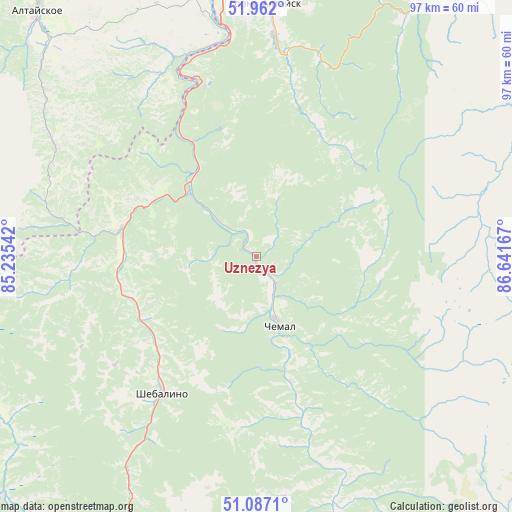
Uznezya GPS coordinates[2]
51° 31' 35.94" North, 85° 56' 18.744" East
| Map corner | latitude | longitude |
|---|---|---|
| Upper-left | 51.962°, | 85.23542° |
| Center: | 51.52665°, | 85.93854° |
| Lower-right: | 51.0871°, | 86.64167° |
| Map W x H: | 97.3×97.3 km | = 60.5×60.5mi |
| max Lat: | 73.50819° ⇑72.4% North |
| Uznezya: | 51.52665° |
| min Lat: | ⇓27.6% South 41.28413° |
| min Long | Uznezya | max Long |
| -179.12198° | 85.93854° | 179.35046° |
| W 83.4%⇐ | ⇒16.6% E |
Elevation
Elevation of Uznezya is 388 m = 1273 ft, and this is 185.4 m = 608 ft above average elevation for this country.
| Max E: |
2518 m = 8261 ft | 12.3% |
| Uznezya | 388 m 1273 ft | |
| Avg. | 202.6 m = 665 ft | |
Min E: |
-28 m = -92 ft | 87.7% |
See also: Russia elevation on elevation.city.
Geographical zone
Uznezya is located in North temperate zone (between Tropic of Cancer and the Arctic Circle). Distance of this North polar circle is 1671.9 km =1038.9 mi to North.| Distance of | km | miles | from Uznezya |
|---|---|---|---|
| North Pole | 4277.8 | 2658.1 | to North |
| Arctic Circle | 1671.9 | 1038.9 | to North |
| Tropic Cancer | 3123.3 | 1940.7 | to South |
| Equator | 5729.2 | 3560 | to South |


Nearby cities:
15 places around Uznezya: (largest is in red/bold)
• Altayskoye
63.2 km =39.3 mi,  318°
318°
• Aya
47.5 km =29.5 mi,  348°
348°
• Chemal
13.6 km =8.5 mi,  160°
160°
• Cherga
26.4 km =16.4 mi,  280°
280°
• Choya
68.2 km =42.4 mi,  37°
37°
• Elekmonar
8.3 km =5.2 mi, 155°
• Gorno-Altaysk
48.3 km =30 mi,  358°
358°
• Il’inka
58.3 km =36.2 mi,  260°
260°
• Kamlak
22 km =13.7 mi,  299°
299°
• Manzherok
35.6 km =22.1 mi,  341°
341°
• Mayma
54.4 km =33.8 mi, 357°
• Platovo
61.5 km =38.2 mi, 357°
• Sarasa
55.9 km =34.7 mi,  314°
314°
• Shebalino
31.8 km =19.8 mi,  214°
214°
• Souzga
40.6 km =25.2 mi, 351°
Sources, notices
• [Note1] Compared only with cities in Russia existing in our database
• [Src1] Map data: © OpenStreetMap contributors (CC-BY-SA)
• [Src2] Other city data from geonames.org with taken over terms of usage.
• [Src3] Geographical zone / Annual Mean Temperature by Robert A. Rohde @ Wikipedia
