Shebalino geodata
Shebalino (Altai) is a populated place; located in Russia in Asia/Barnaul (GMT+7) time zone. With population of 4,939 people, there are 2690 cities with bigger population in this country. Compared to other cities in Russia, 73.5% of cities are located further ↑North; 83% of cities are located further ←West and 97.9% of cities have lower elevation than Shebalino. Note1


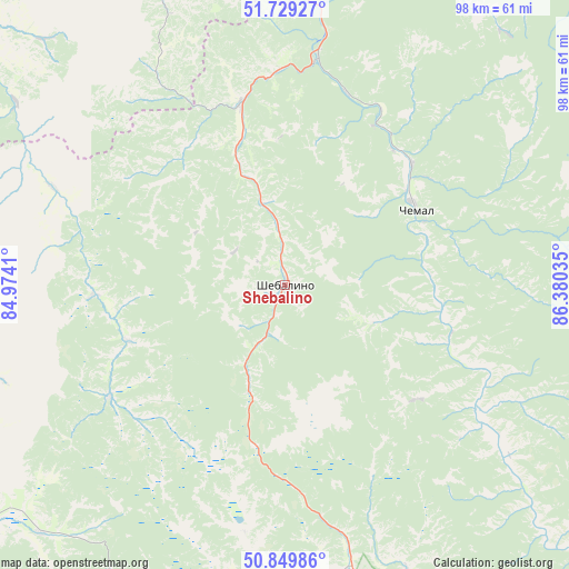
Shebalino GPS coordinates[2]
51° 17' 30.012" North, 85° 40' 37.992" East
| Map corner | latitude | longitude |
|---|---|---|
| Upper-left | 51.72927°, | 84.9741° |
| Center: | 51.29167°, | 85.67722° |
| Lower-right: | 50.84986°, | 86.38035° |
| Map W x H: | 97.8×97.8 km | = 60.8×60.8mi |
| max Lat: | 73.50819° ⇑73.5% North |
| Shebalino: | 51.29167° |
| min Lat: | ⇓26.5% South 41.28413° |
| min Long | Shebalino | max Long |
| -179.12198° | 85.67722° | 179.35046° |
| W 83%⇐ | ⇒17% E |
Elevation
Elevation of Shebalino is 861 m = 2825 ft, and this is 658.4 m = 2160 ft above average elevation for this country.
| Max E: |
2518 m = 8261 ft | 2.1% |
| Shebalino | 861 m 2825 ft | |
| Avg. | 202.6 m = 665 ft | |
Min E: |
-28 m = -92 ft | 97.9% |
See also: Russia elevation on elevation.city.
Geographical zone
Shebalino is located in North temperate zone (between Tropic of Cancer and the Arctic Circle). Distance of this North polar circle is 1698.1 km =1055.2 mi to North.| Distance of | km | miles | from Shebalino |
|---|---|---|---|
| North Pole | 4304 | 2674.4 | to North |
| Arctic Circle | 1698.1 | 1055.2 | to North |
| Tropic Cancer | 3097.2 | 1924.5 | to South |
| Equator | 5703.1 | 3543.7 | to South |


Nearby cities:
15 places around Shebalino: (largest is in red/bold)
• Altayskoye
77.3 km =48 mi,  342°
342°
• Aya
73.2 km =45.5 mi,  6°
6°
• Chemal
26.4 km =16.4 mi,  59°
59°
• Cherga
31.8 km =19.8 mi,  345°
345°
• Elekmonar
28.5 km =17.7 mi,  49°
49°
• Gorno-Altaysk
76.2 km =47.3 mi, 12°
• Il’inka
42.9 km =26.7 mi,  292°
292°
• Kamlak
36.9 km =22.9 mi,  358°
358°
• Manzherok
60.3 km =37.5 mi, 6°
• Mayma
82.1 km =51 mi, 11°
• Onguday
68.7 km =42.7 mi,  151°
151°
• Sarasa
68.7 km =42.7 mi, 341°
• Souzga
67.3 km =41.8 mi, 10°
• Ust’-Kan
75.7 km =47 mi,  237°
237°
• Uznezya
31.8 km =19.8 mi,  34°
34°
Sources, notices
• [Note1] Compared only with cities in Russia existing in our database
• [Src1] Map data: © OpenStreetMap contributors (CC-BY-SA)
• [Src2] Other city data from geonames.org with taken over terms of usage.
• [Src3] Geographical zone / Annual Mean Temperature by Robert A. Rohde @ Wikipedia
