Il’inka geodata
Il’inka (Altai) is a populated place; located in Russia in Asia/Barnaul (GMT+7) time zone. With population of 750 people, there are 4785 cities with bigger population in this country. Compared to other cities in Russia, 72.9% of cities are located further ↑North; 82.3% of cities are located further ←West and 96.9% of cities have lower elevation than Il’inka. Note1


Il’inka GPS coordinates[2]
51° 26' 26.016" North, 85° 6' 28.008" East
| Map corner | latitude | longitude |
|---|---|---|
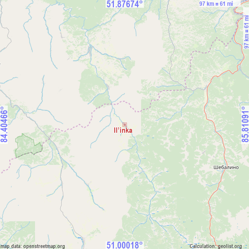
| Upper-left | 51.87674°, | 84.40466° |
| Center: | 51.44056°, | 85.10778° |
| Lower-right: | 51.00018°, | 85.81091° |
| Map W x H: | 97.5×97.5 km | = 60.6×60.6mi |
| max Lat: | 73.50819° ⇑72.9% North |
| Il’inka: | 51.44056° |
| min Lat: | ⇓27.1% South 41.28413° |
| min Long | Il’inka | max Long |
| -179.12198° | 85.10778° | 179.35046° |
| W 82.3%⇐ | ⇒17.7% E |
Elevation
Elevation of Il’inka is 763 m = 2503 ft, and this is 560.4 m = 1839 ft above average elevation for this country.
| Max E: |
2518 m = 8261 ft | 3.1% |
| Il’inka | 763 m 2503 ft | |
| Avg. | 202.6 m = 665 ft | |
Min E: |
-28 m = -92 ft | 96.9% |
See also: Russia elevation on elevation.city.
Geographical zone
Il’inka is located in North temperate zone (between Tropic of Cancer and the Arctic Circle). Distance of this North polar circle is 1681.5 km =1044.8 mi to North.| Distance of | km | miles | from Il’inka |
|---|---|---|---|
| North Pole | 4287.4 | 2664.1 | to North |
| Arctic Circle | 1681.5 | 1044.8 | to North |
| Tropic Cancer | 3113.7 | 1934.8 | to South |
| Equator | 5719.7 | 3554.1 | to South |


Nearby cities:
15 places around Il’inka: (largest is in red/bold)
• Altayskoye
59.1 km =36.7 mi,  15°
15°
• Belokurikha
62.3 km =38.7 mi,  352°
352°
• Chemal
62.3 km =38.7 mi,  93°
93°
• Cherga
34.6 km =21.5 mi,  65°
65°
• Elekmonar
61 km =37.9 mi, 88°
• Kamlak
43.3 km =26.9 mi,  61°
61°
• Manzherok
63.2 km =39.3 mi,  46°
46°
• Sarasa
51.4 km =31.9 mi, 19°
• Shebalino
42.9 km =26.7 mi,  112°
112°
• Soloneshnoye
59.5 km =37 mi,  293°
293°
• Souzga
71.3 km =44.3 mi, 45°
• Starobelokurikha
68 km =42.3 mi,  358°
358°
• Topol’noye
44.1 km =27.4 mi,  280°
280°
• Ust’-Kan
61.9 km =38.5 mi,  202°
202°
• Uznezya
58.3 km =36.2 mi,  80°
80°
Sources, notices
• [Note1] Compared only with cities in Russia existing in our database
• [Src1] Map data: © OpenStreetMap contributors (CC-BY-SA)
• [Src2] Other city data from geonames.org with taken over terms of usage.
• [Src3] Geographical zone / Annual Mean Temperature by Robert A. Rohde @ Wikipedia
