Ust’-Ulagan geodata
Ust’-Ulagan (Altai) is a populated place; located in Russia in Asia/Barnaul (GMT+7) time zone. With population of 2,623 people, there are 3913 cities with bigger population in this country. Compared to other cities in Russia, 76.2% of cities are located further ↑North; 85.1% of cities are located further ←West and 99.1% of cities have lower elevation than Ust’-Ulagan. Note1


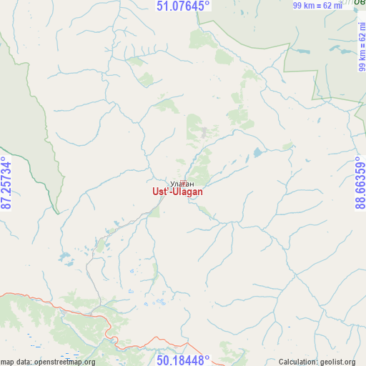
Ust’-Ulagan GPS coordinates[2]
50° 37' 57.288" North, 87° 57' 37.656" East
| Map corner | latitude | longitude |
|---|---|---|
| Upper-left | 51.07645°, | 87.25734° |
| Center: | 50.63258°, | 87.96046° |
| Lower-right: | 50.18448°, | 88.66359° |
| Map W x H: | 99.2×99.2 km | = 61.6×61.6mi |
| max Lat: | 73.50819° ⇑76.2% North |
| Ust’-Ulagan: | 50.63258° |
| min Lat: | ⇓23.8% South 41.28413° |
| min Long | Ust’-Ulagan | max Long |
| -179.12198° | 87.96046° | 179.35046° |
| W 85.1%⇐ | ⇒14.9% E |
Elevation
Elevation of Ust’-Ulagan is 1228 m = 4029 ft, and this is 1025.4 m = 3364 ft above average elevation for this country.
| Max E: |
2518 m = 8261 ft | 0.90000000000001% |
| Ust’-Ulagan | 1228 m 4029 ft | |
| Avg. | 202.6 m = 665 ft | |
Min E: |
-28 m = -92 ft | 99.1% |
See also: Russia elevation on elevation.city.
Geographical zone
Ust’-Ulagan is located in North temperate zone (between Tropic of Cancer and the Arctic Circle). Distance of this North polar circle is 1771.4 km =1100.7 mi to North.| Distance of | km | miles | from Ust’-Ulagan |
|---|---|---|---|
| North Pole | 4377.2 | 2719.9 | to North |
| Arctic Circle | 1771.4 | 1100.7 | to North |
| Tropic Cancer | 3023.9 | 1879 | to South |
| Equator | 5629.8 | 3498.2 | to South |


Nearby cities:
15 places around Ust’-Ulagan: (largest is in red/bold)
• Aktash
40.3 km =25 mi,  203°
203°
• Artybash
137.5 km =85.4 mi,  339°
339°
• Balykcha
74.5 km =46.3 mi,  346°
346°
• Belyashi
109.6 km =68.1 mi, 200°
• Biyka
145.3 km =90.3 mi, 351°
• Chibit
47.1 km =29.3 mi,  221°
221°
• Inya
96.3 km =59.8 mi,  258°
258°
• Iogach
136.7 km =84.9 mi, 339°
• Kosh-Agach
87.4 km =54.3 mi,  144°
144°
• Kupchegen
108.3 km =67.3 mi,  269°
269°
• Kyzyl-Khaya
150.7 km =93.6 mi,  115°
115°
• Onguday
128.2 km =79.7 mi,  275°
275°
• Tashanta
134.6 km =83.6 mi, 139°
• Tebeler
99.5 km =61.8 mi, 143°
• Жана-Аул
110.4 km =68.6 mi, 141°
Sources, notices
• [Note1] Compared only with cities in Russia existing in our database
• [Src1] Map data: © OpenStreetMap contributors (CC-BY-SA)
• [Src2] Other city data from geonames.org with taken over terms of usage.
• [Src3] Geographical zone / Annual Mean Temperature by Robert A. Rohde @ Wikipedia
