Kyzyl-Khaya geodata
Kyzyl-Khaya (Republic of Tyva) is a populated place; located in Russia in Asia/Krasnoyarsk (GMT+7) time zone. With population of 4,046 people, there are 3086 cities with bigger population in this country. Compared to other cities in Russia, 77.9% of cities are located further ↑North; 85.6% of cities are located further ←West and 99.9% of cities have lower elevation than Kyzyl-Khaya. Note1


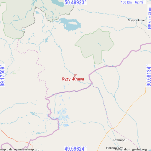
Kyzyl-Khaya GPS coordinates[2]
50° 2' 59.496" North, 89° 52' 41.556" East
| Map corner | latitude | longitude |
|---|---|---|
| Upper-left | 50.49923°, | 89.17509° |
| Center: | 50.04986°, | 89.87821° |
| Lower-right: | 49.59624°, | 90.58134° |
| Map W x H: | 100.4×100.4 km | = 62.4×62.4mi |
| max Lat: | 73.50819° ⇑77.9% North |
| Kyzyl-Khaya: | 50.04986° |
| min Lat: | ⇓22.1% South 41.28413° |
| min Long | Kyzyl-Khaya | max Long |
| -179.12198° | 89.87821° | 179.35046° |
| W 85.6%⇐ | ⇒14.4% E |
Elevation
Elevation of Kyzyl-Khaya is 2004 m = 6575 ft, and this is 1801.4 m = 5910 ft above average elevation for this country.
| Max E: |
2518 m = 8261 ft | 0.099999999999994% |
| Kyzyl-Khaya | 2004 m 6575 ft | |
| Avg. | 202.6 m = 665 ft | |
Min E: |
-28 m = -92 ft | 99.9% |
See also: Russia elevation on elevation.city.
Geographical zone
Kyzyl-Khaya is located in North temperate zone (between Tropic of Cancer and the Arctic Circle). Distance of this North polar circle is 1836.2 km =1141 mi to North.| Distance of | km | miles | from Kyzyl-Khaya |
|---|---|---|---|
| North Pole | 4442 | 2760.1 | to North |
| Arctic Circle | 1836.2 | 1141 | to North |
| Tropic Cancer | 2959.1 | 1838.7 | to South |
| Equator | 5565 | 3457.9 | to South |


Nearby cities:
15 places around Kyzyl-Khaya: (largest is in red/bold)
• Ak-Dovurak
135.9 km =84.4 mi,  21°
21°
• Aktash
155.2 km =96.4 mi,  280°
280°
• Belyashi
179.9 km =111.8 mi,  257°
257°
• Chadan
182.3 km =113.3 mi,  41°
41°
• Chibit
170.7 km =106.1 mi, 280°
• Khandagayty
171.7 km =106.7 mi,  63°
63°
• Kosh-Agach
86.1 km =53.5 mi,  265°
265°
• Kyzyl-Mazhalyk
131.6 km =81.8 mi, 22°
• Mugur-Aksy
54.2 km =33.7 mi,  47°
47°
• Sut-Khol’
180.8 km =112.3 mi,  33°
33°
• Tashanta
61.5 km =38.2 mi,  232°
232°
• Tebeler
79 km =49.1 mi, 258°
• Teeli
109.7 km =68.2 mi,  12°
12°
• Ust’-Ulagan
150.7 km =93.6 mi,  295°
295°
• Жана-Аул
72.3 km =44.9 mi,  252°
252°
Sources, notices
• [Note1] Compared only with cities in Russia existing in our database
• [Src1] Map data: © OpenStreetMap contributors (CC-BY-SA)
• [Src2] Other city data from geonames.org with taken over terms of usage.
• [Src3] Geographical zone / Annual Mean Temperature by Robert A. Rohde @ Wikipedia
