Aktash geodata
Aktash (Altai) is a populated place; located in Russia in Asia/Barnaul (GMT+7) time zone. With population of 3,374 people, there are 3481 cities with bigger population in this country. Compared to other cities in Russia, 77.3% of cities are located further ↑North; 84.9% of cities are located further ←West and 100% of cities have lower elevation than Aktash. Note1


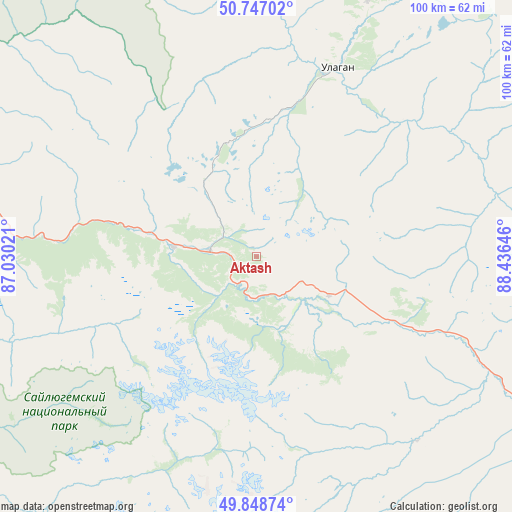
Aktash GPS coordinates[2]
50° 18' 0" North, 87° 43' 59.988" East
| Map corner | latitude | longitude |
|---|---|---|
| Upper-left | 50.74702°, | 87.03021° |
| Center: | 50.3°, | 87.73333° |
| Lower-right: | 49.84874°, | 88.43646° |
| Map W x H: | 99.9×99.9 km | = 62.1×62.1mi |
| max Lat: | 73.50819° ⇑77.3% North |
| Aktash: | 50.3° |
| min Lat: | ⇓22.7% South 41.28413° |
| min Long | Aktash | max Long |
| -179.12198° | 87.73333° | 179.35046° |
| W 84.9%⇐ | ⇒15.1% E |
Elevation
Elevation of Aktash is 2157 m = 7077 ft, and this is 1954.4 m = 6412 ft above average elevation for this country.
| Max E: |
2518 m = 8261 ft | 0% |
| Aktash | 2157 m 7077 ft | |
| Avg. | 202.6 m = 665 ft | |
Min E: |
-28 m = -92 ft | 100% |
See also: Russia elevation on elevation.city.
Geographical zone
Aktash is located in North temperate zone (between Tropic of Cancer and the Arctic Circle). Distance of this North polar circle is 1808.3 km =1123.6 mi to North.| Distance of | km | miles | from Aktash |
|---|---|---|---|
| North Pole | 4414.2 | 2742.9 | to North |
| Arctic Circle | 1808.3 | 1123.6 | to North |
| Tropic Cancer | 2986.9 | 1856 | to South |
| Equator | 5592.8 | 3475.2 | to South |


Nearby cities:
15 places around Aktash: (largest is in red/bold)
• Balykcha
109.6 km =68.1 mi,  359°
359°
• Belyashi
69.4 km =43.1 mi,  198°
198°
• Chibit
15.5 km =9.6 mi,  276°
276°
• Inya
80.4 km =50 mi, 282°
• Kosh-Agach
75.4 km =46.9 mi,  116°
116°
• Kupchegen
99.2 km =61.6 mi,  291°
291°
• Mul’ta
127 km =78.9 mi,  263°
263°
• Onguday
122.6 km =76.2 mi, 294°
• Tashanta
123 km =76.4 mi, 121°
• Tebeler
87 km =54.1 mi, 119°
• Ust’-Koksa
150.8 km =93.7 mi,  268°
268°
• Ust’-Ulagan
40.3 km =25 mi,  23°
23°
• Verkh-Uymon
142.1 km =88.3 mi, 266°
• Verkhniy Uymon
142.1 km =88.3 mi, 266°
• Жана-Аул
98.2 km =61 mi, 120°
Sources, notices
• [Note1] Compared only with cities in Russia existing in our database
• [Src1] Map data: © OpenStreetMap contributors (CC-BY-SA)
• [Src2] Other city data from geonames.org with taken over terms of usage.
• [Src3] Geographical zone / Annual Mean Temperature by Robert A. Rohde @ Wikipedia
