Kosh-Agach geodata
Kosh-Agach (Altai) is a populated place; located in Russia in Asia/Barnaul (GMT+7) time zone. With population of 5,732 people, there are 2352 cities with bigger population in this country. Compared to other cities in Russia, 78% of cities are located further ↑North; 85.3% of cities are located further ←West and 99.7% of cities have lower elevation than Kosh-Agach. Note1


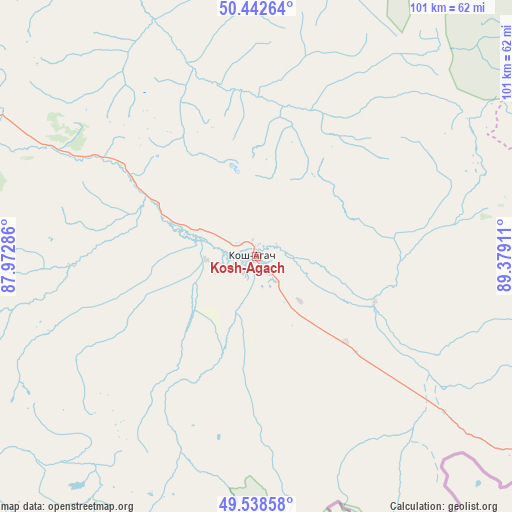
Kosh-Agach GPS coordinates[2]
49° 59' 33.828" North, 88° 40' 33.528" East
| Map corner | latitude | longitude |
|---|---|---|
| Upper-left | 50.44264°, | 87.97286° |
| Center: | 49.99273°, | 88.67598° |
| Lower-right: | 49.53858°, | 89.37911° |
| Map W x H: | 100.5×100.5 km | = 62.4×62.4mi |
| max Lat: | 73.50819° ⇑78% North |
| Kosh-Agach: | 49.99273° |
| min Lat: | ⇓22% South 41.28413° |
| min Long | Kosh-Agach | max Long |
| -179.12198° | 88.67598° | 179.35046° |
| W 85.3%⇐ | ⇒14.7% E |
Elevation
Elevation of Kosh-Agach is 1750 m = 5741 ft, and this is 1547.4 m = 5077 ft above average elevation for this country.
| Max E: |
2518 m = 8261 ft | 0.3% |
| Kosh-Agach | 1750 m 5741 ft | |
| Avg. | 202.6 m = 665 ft | |
Min E: |
-28 m = -92 ft | 99.7% |
See also: Russia elevation on elevation.city.
Geographical zone
Kosh-Agach is located in North temperate zone (between Tropic of Cancer and the Arctic Circle). Distance of this North polar circle is 1842.5 km =1144.9 mi to North.| Distance of | km | miles | from Kosh-Agach |
|---|---|---|---|
| North Pole | 4448.4 | 2764.1 | to North |
| Arctic Circle | 1842.5 | 1144.9 | to North |
| Tropic Cancer | 2952.8 | 1834.8 | to South |
| Equator | 5558.7 | 3454 | to South |


Nearby cities:
15 places around Kosh-Agach: (largest is in red/bold)
• Ak-Dovurak
189.7 km =117.9 mi,  45°
45°
• Aktash
75.4 km =46.9 mi,  296°
296°
• Balykcha
158.8 km =98.7 mi,  334°
334°
• Belyashi
95.2 km =59.2 mi,  250°
250°
• Chibit
90.1 km =56 mi,  293°
293°
• Inya
154.6 km =96.1 mi, 289°
• Kupchegen
174.4 km =108.4 mi, 293°
• Kyzyl-Khaya
86.1 km =53.5 mi,  85°
85°
• Kyzyl-Mazhalyk
185.8 km =115.5 mi, 46°
• Mugur-Aksy
132.6 km =82.4 mi,  71°
71°
• Tashanta
48.3 km =30 mi,  129°
129°
• Tebeler
12.2 km =7.6 mi,  136°
136°
• Teeli
156.8 km =97.4 mi,  43°
43°
• Ust’-Ulagan
87.4 km =54.3 mi,  324°
324°
• Жана-Аул
23.4 km =14.5 mi, 132°
Sources, notices
• [Note1] Compared only with cities in Russia existing in our database
• [Src1] Map data: © OpenStreetMap contributors (CC-BY-SA)
• [Src2] Other city data from geonames.org with taken over terms of usage.
• [Src3] Geographical zone / Annual Mean Temperature by Robert A. Rohde @ Wikipedia
