Ust’-Koksa geodata
Ust’-Koksa (Altai) is a populated place; located in Russia in Asia/Barnaul (GMT+7) time zone. With population of 4,008 people, there are 3108 cities with bigger population in this country. Compared to other cities in Russia, 77.4% of cities are located further ↑North; 82.8% of cities are located further ←West and 98.6% of cities have lower elevation than Ust’-Koksa. Note1


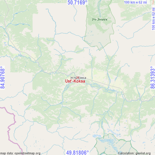
Ust’-Koksa GPS coordinates[2]
50° 16' 10.56" North, 85° 36' 38.88" East
| Map corner | latitude | longitude |
|---|---|---|
| Upper-left | 50.7169°, | 84.90768° |
| Center: | 50.2696°, | 85.6108° |
| Lower-right: | 49.81806°, | 86.31393° |
| Map W x H: | 99.9×99.9 km | = 62.1×62.1mi |
| max Lat: | 73.50819° ⇑77.4% North |
| Ust’-Koksa: | 50.2696° |
| min Lat: | ⇓22.6% South 41.28413° |
| min Long | Ust’-Koksa | max Long |
| -179.12198° | 85.6108° | 179.35046° |
| W 82.8%⇐ | ⇒17.2% E |
Elevation
Elevation of Ust’-Koksa is 978 m = 3209 ft, and this is 775.4 m = 2544 ft above average elevation for this country.
| Max E: |
2518 m = 8261 ft | 1.4% |
| Ust’-Koksa | 978 m 3209 ft | |
| Avg. | 202.6 m = 665 ft | |
Min E: |
-28 m = -92 ft | 98.6% |
See also: Russia elevation on elevation.city.
Geographical zone
Ust’-Koksa is located in North temperate zone (between Tropic of Cancer and the Arctic Circle). Distance of this North polar circle is 1811.7 km =1125.7 mi to North.| Distance of | km | miles | from Ust’-Koksa |
|---|---|---|---|
| North Pole | 4417.6 | 2745 | to North |
| Arctic Circle | 1811.7 | 1125.7 | to North |
| Tropic Cancer | 2983.5 | 1853.9 | to South |
| Equator | 5589.5 | 3473.2 | to South |


Nearby cities:
15 places around Ust’-Koksa: (largest is in red/bold)
• Belyashi
143.8 km =89.4 mi,  115°
115°
• Chemal
129.9 km =80.7 mi,  12°
12°
• Cherga
144.5 km =89.8 mi,  358°
358°
• Chibit
135.5 km =84.2 mi,  87°
87°
• Elekmonar
134.9 km =83.8 mi, 11°
• Il’inka
134.9 km =83.8 mi,  344°
344°
• Inya
75 km =46.6 mi,  73°
73°
• Kupchegen
69.6 km =43.2 mi,  55°
55°
• Mul’ta
27 km =16.8 mi,  113°
113°
• Onguday
65.6 km =40.8 mi,  35°
35°
• Shebalino
113.7 km =70.6 mi,  2°
2°
• Ust’-Kan
94.6 km =58.8 mi,  320°
320°
• Uznezya
141.6 km =88 mi, 9°
• Verkh-Uymon
11.1 km =6.9 mi, 124°
• Verkhniy Uymon
11.1 km =6.9 mi, 124°
Sources, notices
• [Note1] Compared only with cities in Russia existing in our database
• [Src1] Map data: © OpenStreetMap contributors (CC-BY-SA)
• [Src2] Other city data from geonames.org with taken over terms of usage.
• [Src3] Geographical zone / Annual Mean Temperature by Robert A. Rohde @ Wikipedia
