Ust’-Kan geodata
Ust’-Kan (Altai) is a populated place; located in Russia in Asia/Barnaul (GMT+7) time zone. With population of 3,547 people, there are 3375 cities with bigger population in this country. Compared to other cities in Russia, 75.2% of cities are located further ↑North; 82% of cities are located further ←West and 98.7% of cities have lower elevation than Ust’-Kan. Note1


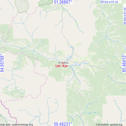
Ust’-Kan GPS coordinates[2]
50° 55' 39.36" North, 84° 45' 39.6" East
| Map corner | latitude | longitude |
|---|---|---|
| Upper-left | 51.36867°, | 84.05788° |
| Center: | 50.9276°, | 84.761° |
| Lower-right: | 50.48231°, | 85.46413° |
| Map W x H: | 98.6×98.6 km | = 61.3×61.3mi |
| max Lat: | 73.50819° ⇑75.2% North |
| Ust’-Kan: | 50.9276° |
| min Lat: | ⇓24.8% South 41.28413° |
| min Long | Ust’-Kan | max Long |
| -179.12198° | 84.761° | 179.35046° |
| W 82%⇐ | ⇒18% E |
Elevation
Elevation of Ust’-Kan is 1042 m = 3419 ft, and this is 839.4 m = 2754 ft above average elevation for this country.
| Max E: |
2518 m = 8261 ft | 1.3% |
| Ust’-Kan | 1042 m 3419 ft | |
| Avg. | 202.6 m = 665 ft | |
Min E: |
-28 m = -92 ft | 98.7% |
See also: Russia elevation on elevation.city.
Geographical zone
Ust’-Kan is located in North temperate zone (between Tropic of Cancer and the Arctic Circle). Distance of this North polar circle is 1738.6 km =1080.3 mi to North.| Distance of | km | miles | from Ust’-Kan |
|---|---|---|---|
| North Pole | 4344.4 | 2699.5 | to North |
| Arctic Circle | 1738.6 | 1080.3 | to North |
| Tropic Cancer | 3056.7 | 1899.3 | to South |
| Equator | 5662.6 | 3518.6 | to South |


Nearby cities:
15 places around Ust’-Kan: (largest is in red/bold)
• Charyshskoye
98.7 km =61.3 mi,  301°
301°
• Chemal
102 km =63.4 mi,  58°
58°
• Cherga
90.5 km =56.2 mi,  38°
38°
• Elekmonar
103.9 km =64.6 mi, 55°
• Il’inka
61.9 km =38.5 mi,  22°
22°
• Kamlak
99.5 km =61.8 mi, 38°
• Onguday
99.5 km =61.8 mi,  101°
101°
• Sentelek
76.8 km =47.7 mi,  293°
293°
• Shebalino
75.7 km =47 mi, 57°
• Soloneshnoye
86.4 km =53.7 mi,  339°
339°
• Topol’noye
67.7 km =42.1 mi, 343°
• Ust’-Koksa
94.6 km =58.8 mi,  140°
140°
• Uznezya
105.6 km =65.6 mi,  50°
50°
• Verkh-Uymon
105.3 km =65.4 mi, 138°
• Verkhniy Uymon
105.3 km =65.4 mi, 138°
Sources, notices
• [Note1] Compared only with cities in Russia existing in our database
• [Src1] Map data: © OpenStreetMap contributors (CC-BY-SA)
• [Src2] Other city data from geonames.org with taken over terms of usage.
• [Src3] Geographical zone / Annual Mean Temperature by Robert A. Rohde @ Wikipedia
