Verkh-Uymon geodata
Verkh-Uymon (Altai) is a populated place; located in Russia in Asia/Barnaul (GMT+7) time zone. With population of 579 people, there are 4908 cities with bigger population in this country. Compared to other cities in Russia, 77.5% of cities are located further ↑North; 83% of cities are located further ←West and 98.4% of cities have lower elevation than Verkh-Uymon. Note1


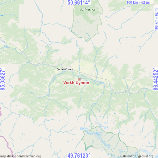
Verkh-Uymon GPS coordinates[2]
50° 12' 47.916" North, 85° 44' 21.804" East
| Map corner | latitude | longitude |
|---|---|---|
| Upper-left | 50.66114°, | 85.03627° |
| Center: | 50.21331°, | 85.73939° |
| Lower-right: | 49.76123°, | 86.44252° |
| Map W x H: | 100.1×100.1 km | = 62.2×62.2mi |
| max Lat: | 73.50819° ⇑77.5% North |
| Verkh-Uymon: | 50.21331° |
| min Lat: | ⇓22.5% South 41.28413° |
| min Long | Verkh-Uymon | max Long |
| -179.12198° | 85.73939° | 179.35046° |
| W 83%⇐ | ⇒17% E |
Elevation
Elevation of Verkh-Uymon is 943 m = 3094 ft, and this is 740.4 m = 2429 ft above average elevation for this country.
| Max E: |
2518 m = 8261 ft | 1.6% |
| Verkh-Uymon | 943 m 3094 ft | |
| Avg. | 202.6 m = 665 ft | |
Min E: |
-28 m = -92 ft | 98.4% |
See also: Russia elevation on elevation.city.
Geographical zone
Verkh-Uymon is located in North temperate zone (between Tropic of Cancer and the Arctic Circle). Distance of this North polar circle is 1818 km =1129.7 mi to North.| Distance of | km | miles | from Verkh-Uymon |
|---|---|---|---|
| North Pole | 4423.9 | 2748.9 | to North |
| Arctic Circle | 1818 | 1129.7 | to North |
| Tropic Cancer | 2977.3 | 1850 | to South |
| Equator | 5583.2 | 3469.2 | to South |


Nearby cities:
15 places around Verkh-Uymon: (largest is in red/bold)
• Aktash
142.1 km =88.3 mi,  86°
86°
• Belyashi
132.8 km =82.5 mi,  114°
114°
• Chemal
134.5 km =83.6 mi,  7°
7°
• Chibit
126.8 km =78.8 mi,  84°
84°
• Elekmonar
139.6 km =86.7 mi, 7°
• Il’inka
143.5 km =89.2 mi,  341°
341°
• Inya
68.5 km =42.6 mi,  66°
66°
• Kupchegen
66.4 km =41.3 mi,  47°
47°
• Mul’ta
16.2 km =10.1 mi, 106°
• Onguday
66.4 km =41.3 mi,  25°
25°
• Shebalino
120 km =74.6 mi,  357°
357°
• Ust’-Kan
105.3 km =65.4 mi,  318°
318°
• Ust’-Koksa
11.1 km =6.9 mi,  304°
304°
• Uznezya
146.7 km =91.2 mi, 5°
• Verkhniy Uymon
0 km =0 mi,  147°
147°
Sources, notices
• [Note1] Compared only with cities in Russia existing in our database
• [Src1] Map data: © OpenStreetMap contributors (CC-BY-SA)
• [Src2] Other city data from geonames.org with taken over terms of usage.
• [Src3] Geographical zone / Annual Mean Temperature by Robert A. Rohde @ Wikipedia
