Tal’menka geodata
Tal’menka (Altai Krai) is a populated place; located in Russia in Asia/Barnaul (GMT+7) time zone. With population of 18,900 people, there are 912 cities with bigger population in this country. Compared to other cities in Russia, 56.6% of cities are located further ↑North; 81% of cities are located further ←West and 51.1% of cities have higher elevation than Tal’menka. Note1


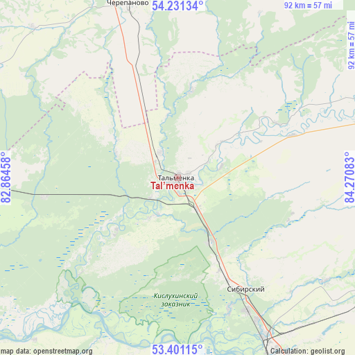
Tal’menka GPS coordinates[2]
53° 49' 5.88" North, 83° 34' 3.72" East
| Map corner | latitude | longitude |
|---|---|---|
| Upper-left | 54.23134°, | 82.86458° |
| Center: | 53.8183°, | 83.5677° |
| Lower-right: | 53.40115°, | 84.27083° |
| Map W x H: | 92.3×92.3 km | = 57.4×57.4mi |
| max Lat: | 73.50819° ⇑56.6% North |
| Tal’menka: | 53.8183° |
| min Lat: | ⇓43.4% South 41.28413° |
| min Long | Tal’menka | max Long |
| -179.12198° | 83.5677° | 179.35046° |
| W 81%⇐ | ⇒19% E |
Elevation
Elevation of Tal’menka is 142 m = 466 ft, and this is 60.6 m = 199 ft below average elevation for this country.
| Max E: |
2518 m = 8261 ft | 51.1% |
| Avg. | 202.6 m = 665 ft | |
| Tal’menka | 142 m = 466 ft | |
Min E: |
-28 m = -92 ft | 48.9% |
See also: Russia elevation on elevation.city.
Geographical zone
Tal’menka is located in North temperate zone (between Tropic of Cancer and the Arctic Circle). Distance of this North polar circle is 1417.1 km =880.5 mi to North.| Distance of | km | miles | from Tal’menka |
|---|---|---|---|
| North Pole | 4023 | 2499.8 | to North |
| Arctic Circle | 1417.1 | 880.5 | to North |
| Tropic Cancer | 3378.1 | 2099.1 | to South |
| Equator | 5984 | 3718.3 | to South |


Nearby cities:
15 places around Tal’menka: (largest is in red/bold)
• Barnaul
52.5 km =32.6 mi,  165°
165°
• Beloyarsk
47 km =29.2 mi,  151°
151°
• Borovikha
38.9 km =24.2 mi, 152°
• Cherepanovo
46.5 km =28.9 mi,  344°
344°
• Gon’ba
44.6 km =27.7 mi,  179°
179°
• Logovskoye
55.2 km =34.3 mi,  130°
130°
• Nauchnyy Gorodok
44.4 km =27.6 mi, 183°
• Novoaltaysk
53.3 km =33.1 mi, 152°
• Novomikhaylovka
52.4 km =32.6 mi,  186°
186°
• Novosilikatnyy
56.7 km =35.2 mi, 176°
• Pervomayskoye
31.5 km =19.6 mi,  110°
110°
• Shakhi
55.3 km =34.4 mi, 194°
• Sibirskiy
29.5 km =18.3 mi, 154°
• Vlasikha
57.9 km =36 mi, 179°
• Zudilovo
42.1 km =26.2 mi, 149°
Sources, notices
• [Note1] Compared only with cities in Russia existing in our database
• [Src1] Map data: © OpenStreetMap contributors (CC-BY-SA)
• [Src2] Other city data from geonames.org with taken over terms of usage.
• [Src3] Geographical zone / Annual Mean Temperature by Robert A. Rohde @ Wikipedia
