Poltavka geodata
Poltavka (Omsk) is a populated place; located in Russia in Asia/Omsk (GMT+6) time zone. With population of 7,103 people, there are 1973 cities with bigger population in this country. Compared to other cities in Russia, 52.2% of cities are located further ↑North; 77.3% of cities are located further ←West and 59.2% of cities have higher elevation than Poltavka. Note1


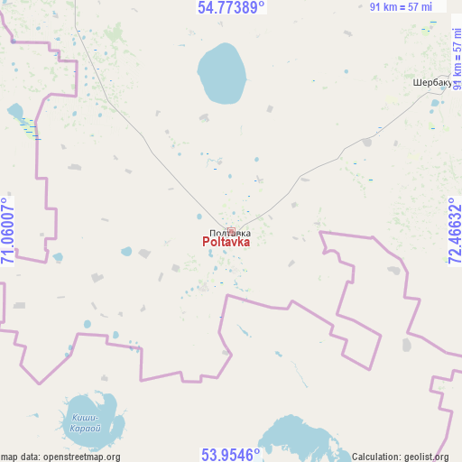
Poltavka GPS coordinates[2]
54° 21' 58.644" North, 71° 45' 47.484" East
| Map corner | latitude | longitude |
|---|---|---|
| Upper-left | 54.77389°, | 71.06007° |
| Center: | 54.36629°, | 71.76319° |
| Lower-right: | 53.9546°, | 72.46632° |
| Map W x H: | 91.1×91.1 km | = 56.6×56.6mi |
| max Lat: | 73.50819° ⇑52.2% North |
| Poltavka: | 54.36629° |
| min Lat: | ⇓47.8% South 41.28413° |
| min Long | Poltavka | max Long |
| -179.12198° | 71.76319° | 179.35046° |
| W 77.3%⇐ | ⇒22.7% E |
Elevation
Elevation of Poltavka is 126 m = 413 ft, and this is 76.6 m = 251 ft below average elevation for this country.
| Max E: |
2518 m = 8261 ft | 59.2% |
| Avg. | 202.6 m = 665 ft | |
| Poltavka | 126 m = 413 ft | |
Min E: |
-28 m = -92 ft | 40.8% |
See also: Russia elevation on elevation.city.
Geographical zone
Poltavka is located in North temperate zone (between Tropic of Cancer and the Arctic Circle). Distance of this North polar circle is 1356.2 km =842.7 mi to North.| Distance of | km | miles | from Poltavka |
|---|---|---|---|
| North Pole | 3962.1 | 2461.9 | to North |
| Arctic Circle | 1356.2 | 842.7 | to North |
| Tropic Cancer | 3439 | 2136.9 | to South |
| Equator | 6045 | 3756.2 | to South |


Nearby cities:
15 places around Poltavka: (largest is in red/bold)
• Azovo
89.4 km =55.6 mi,  65°
65°
• Beregovoy
129.5 km =80.5 mi,  46°
46°
• Irtyshskiy
127.6 km =79.3 mi, 67°
• Krasnyy Yar
122.7 km =76.2 mi,  37°
37°
• Luzino
104.3 km =64.8 mi, 51°
• Lyubinskiy
106 km =65.9 mi,  34°
34°
• Nazyvayevsk
136.3 km =84.7 mi,  348°
348°
• Novoomskiy
112.3 km =69.8 mi,  61°
61°
• Odesskoye
79.8 km =49.6 mi,  102°
102°
• Omsk
124.5 km =77.4 mi, 55°
• Pavlogradka
118 km =73.3 mi, 98°
• Rostovka
113.5 km =70.5 mi,  4°
4°
• Sherbakul’
50.4 km =31.3 mi, 54°
• Tavricheskoye
123.6 km =76.8 mi,  78°
78°
• Vkhodnoy
111.5 km =69.3 mi, 54°
Sources, notices
• [Note1] Compared only with cities in Russia existing in our database
• [Src1] Map data: © OpenStreetMap contributors (CC-BY-SA)
• [Src2] Other city data from geonames.org with taken over terms of usage.
• [Src3] Geographical zone / Annual Mean Temperature by Robert A. Rohde @ Wikipedia
